how to purchase satellite imagery?
The standard procedure for purchasing high resolution satellite imagery
Satellite imagery data are high-definition pictures taken by satellites. No matter whether government departments, companies, or individuals, they can buy the satellite imagery data products they need.
Satellite imagery data is a highly customized electronic product (location, time, and resolution), so how to buy satellite imagery? Today, we will give you a brief introduction.
Step 1: 【Determine the scope】
The most important feature of satellite imagery data is its location information, so you need to tell us the exact location of the satellite imagery where you need to buy it. You can determine the scope in the following ways:
- Coordinates: the latitude and longitude coordinates of the required position, which can be in the format of degrees, minutes, and seconds or degrees.(eg:112°23′45〃,12°22′44〃,or 121.3727° 44.5591°)
- KML Files: professional users can directly provide vector files in kml/kmz/shapefile format, and the vector files are required to be in WGS84 latitude and longitude coordinate system.
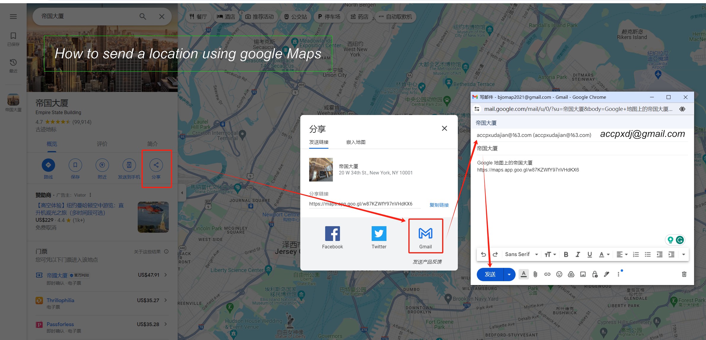
- Google Maps Positioning: Use Google Maps to locate the required location, and then share the positioning with us. (you don't have to arrive at the location site; for example, I am able to use Google Maps to send a location of New York when I am in Beijing).
- Place Names that can be searched in Google Maps. (it is better to have one search result in Google Maps otherwise we are not sure which one you need)
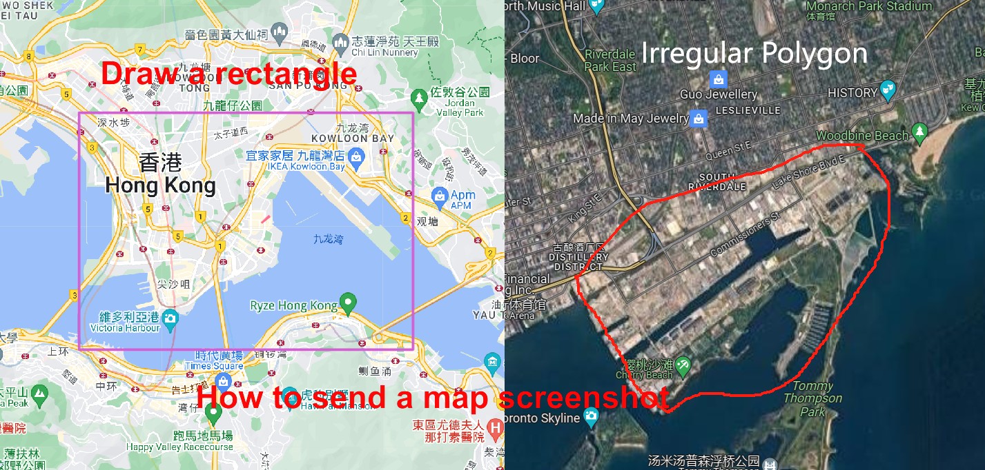
- Map Screenshot : Google map screenshot or OpenStreet Map screenshot, preferably with name or coordinates.
Step 2: 【Confirm the Date】
Do you need the latest satellite imagery (the latest may be the current day) or the earliest satellite imagery (as early as 1960), or the satellite imagery of a specific year (such as 2010)? Is there any special requirement for the season and month (there is a clear difference between winter and summer)? We can provide satellite images from 1960 to 2024. The high-definition satellite images are updated every year (at present, they can be updated 1-4 times a month), the medium and low-resolution satellite images are updated 1-4 times or even many times a month, and the fastest satellites can be updated every day.
Step 3: 【Determine the Resolution】
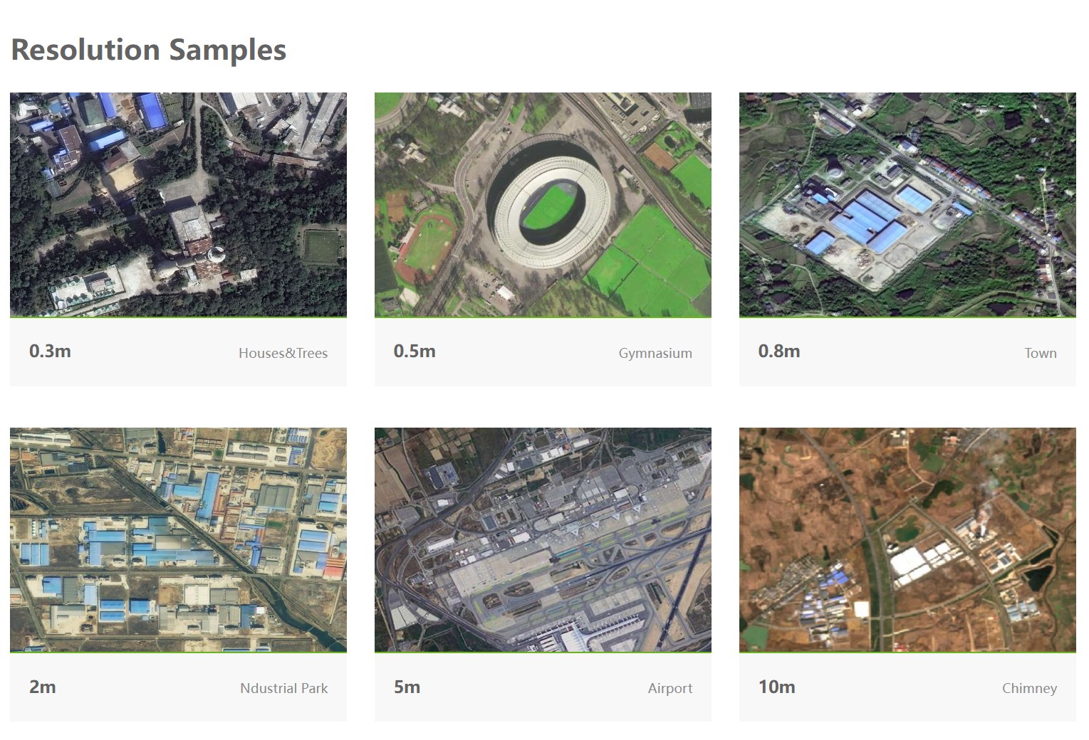
The spatial resolution of satellite imagery determines the definition of satellite image. At present, the highest resolution is 0.3m, and the order of satellite resolution from high to low is 0.3m > 0.5m > 0.8m > 1m > 1.5m > 2m > 4m > 10m > 15m > 30m > 60m.
At present, the highest resolution of the satellite is the 0.3-meter resolution satellite image taken by the French PNEO satellite and American WorldView3 satellite, which has the highest resolution and can identify the details of houses and roads. 0.3-meter imagery can be used for small-scale planning and design projects in the main urban area of the city. Secondly, the 0.5-meter-resolution satellite includes American WorldView series satellites, French Pleiades satellites, Chinese SuperView satellites, and Jilin satellites. 0.5-meter satellites have the most data and are updated almost every month. In addition, there are 0.8-meter satellite images taken by Chinese GF-2 satellite, 1.5-meter resolution satellite images taken by French SPOT6-6 satellite, 2-meter resolution satellite images taken by Chinese GF1 series satellites, and 3-4-meter resolution satellite images updated almost every day.
How to choose from so many resolution options?
For a small area, such as a house, a park, or a field, and need to see the details of the house and field, it'd better be 0.3-meter or 0.5-meter resolution.
For a medium area, such as the urban area of a city or tens to hundreds of square kilometers, and you want to see the buildings, farmland, and other features clearly,
it'd better be 0.5-meter to 1.5-meter resolution.
For a large area, such as the whole area of a county or prefecture-level city, thousands or even tens of thousands of square kilometers,
and the definition requirement is not particularly high, it'd better be 1-2 meters resolution.
For a super large area, such as a province, or your budget is low, only a few thousand dollars, but you want to buy a large scope satellite imagery,
it'd better be 10-30 meters resolution.
Step 4: 【Data querying】
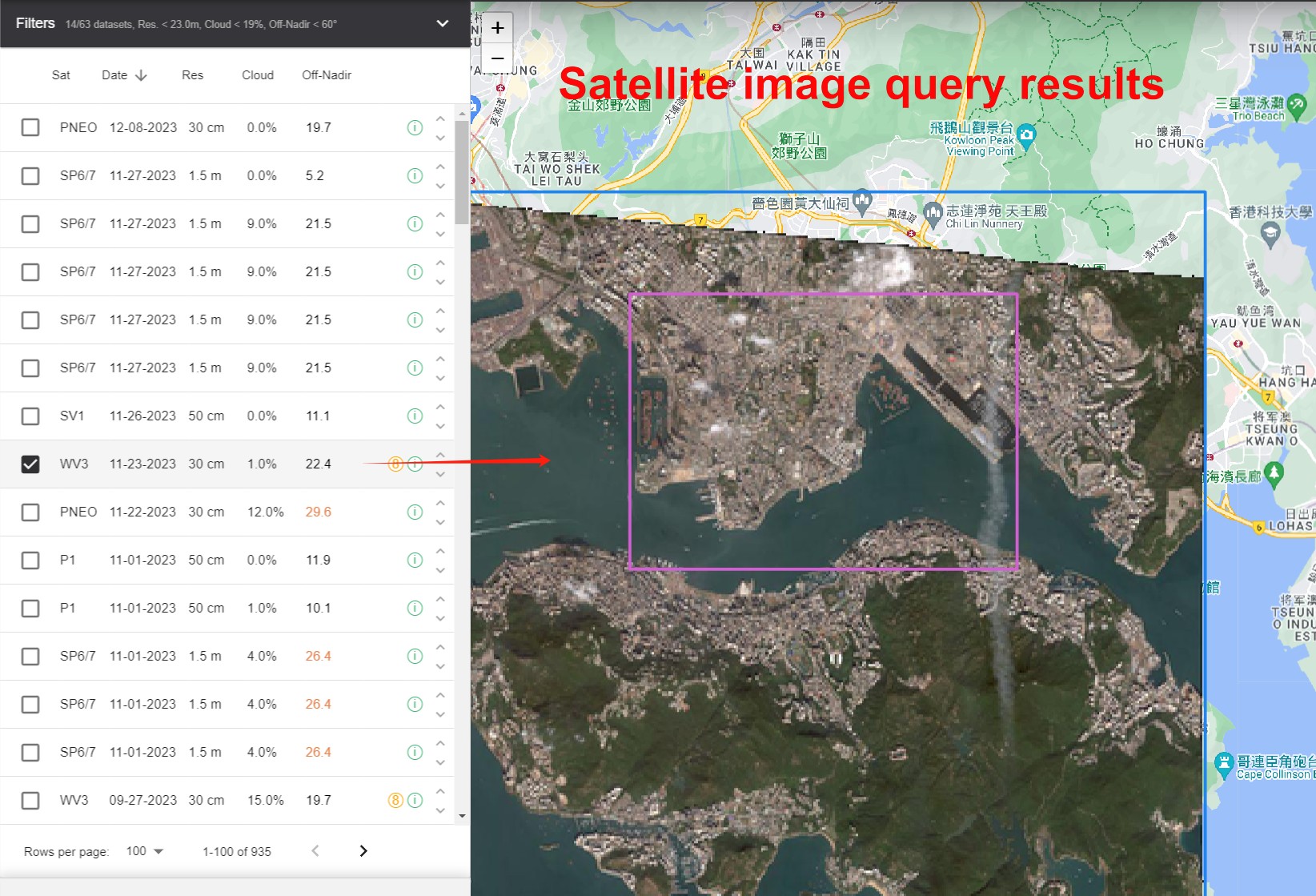
After the satellite image range and image date are determined, we will query all the available archived data within the target area that meet the time requirement in the satellite company's query system, and then we will tell you which satellites have collected the matched data, and the specific year, month and day of shooting, the resolution and cloud amount of satellite images, a highly compressed query preview and the price of each data. You can select which satellite imagery to use according to the shooting date, resolution, and price.
How to calculate the price of buying satellite images?
Satellite images are sold by area, and the calculation formula is:
the area of purchased satellite images R * the unit price P of selected satellite images.
The higher the resolution of satellite images, the more expensive the price P is, and the newer the shooting time of satellite images, the more expensive the price P is.
The unit price of high-definition satellite images is about 100-400 yuan per square kilometer, depending on the actual requirements of customers.
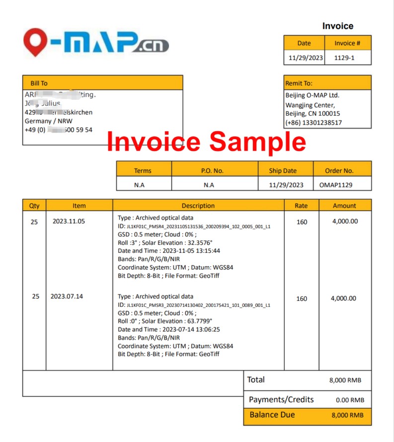
Step 5: 【Quote and Invoice】
When the imagery data is selected, we draft the purchase Quote according to the unified template. At this time, we need the customer to provide the company name, address, and receiving mailbox (satellite imagery is a kind of electronic product, and the network disk is the default delivery method). Quote mainly stipulates the purchase area, the specific shooting time, satellite name, cloud amount, processing content, projection coordinate system, delivery method, delivery cycle, total price and payment method, etc.
Our company has two offices, one in Beijing and one in Hong Kong. Overseas customers can choose one of them to sign contracts. After the Quote is signed, we will issue an electronic invoice to the customer.
If you choose the Hong Kong company to sign the contract, then we can provide a commercial invoice in Hong Kong.
If you choose the Beijing company, we can provide the official electronic invoice issued by the Chinese mainland tax department, or our company's commercial invoice.
Step 6:【Payment】
After receiving our electronic invoice, the client should transfer the money to our company account within 5 working days. If it is purchased by an individual or paid by personal account, you can transfer money by mobile online banking or remit money to our company account at the bank counter, and write down the name of the remitter+satellite image purchase fee in the payment remarks column.
Our Beijing company can accept remittance in CNY, USD and EUR, and our Hong Kong company can accept remittance in CNY, HKD, USD and EUR. In order to make payment easier and more convenient, customers can choose AliPay,WeChatPay,PayPal,HSBC bank transfer to transfer money to our individual account.
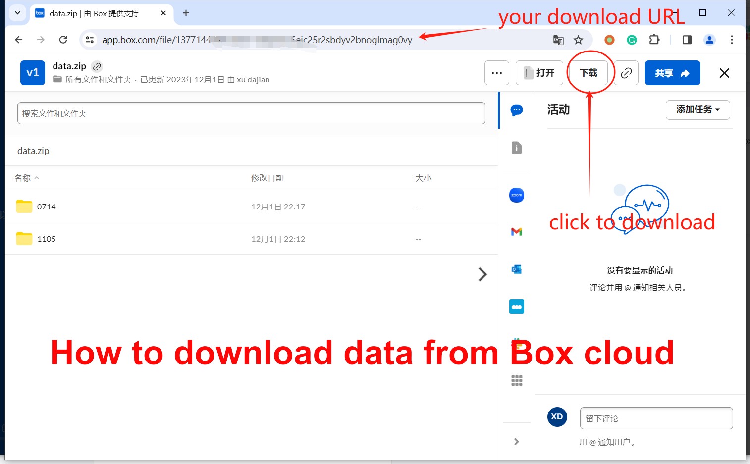
Step 7:【Production and Delivery】
The primary condition for us to start production is to receive the payment from customers. After receiving the payment from customers, we will immediately start the production of satellite images.
Generally, the production and delivery of regular-sized projects will be completed in 5-10 working days, and large-scale projects are expected to be completed in 2-4 weeks. Because satellite images are electronic products, cloud disk is the default delivery method. After the data is produced, we upload the data to the cloud disk and then send the download link to the email designated by the customer.
OMAP is a well-known satellite image data service provider in China which can provide high-resolution commercial satellite data from nearly 200 satellites worldwide. We will serve you with professional technology and an honest and trustworthy attitude. Please contact us to purchase satellite image data, and click online search to see more satellite project cases.
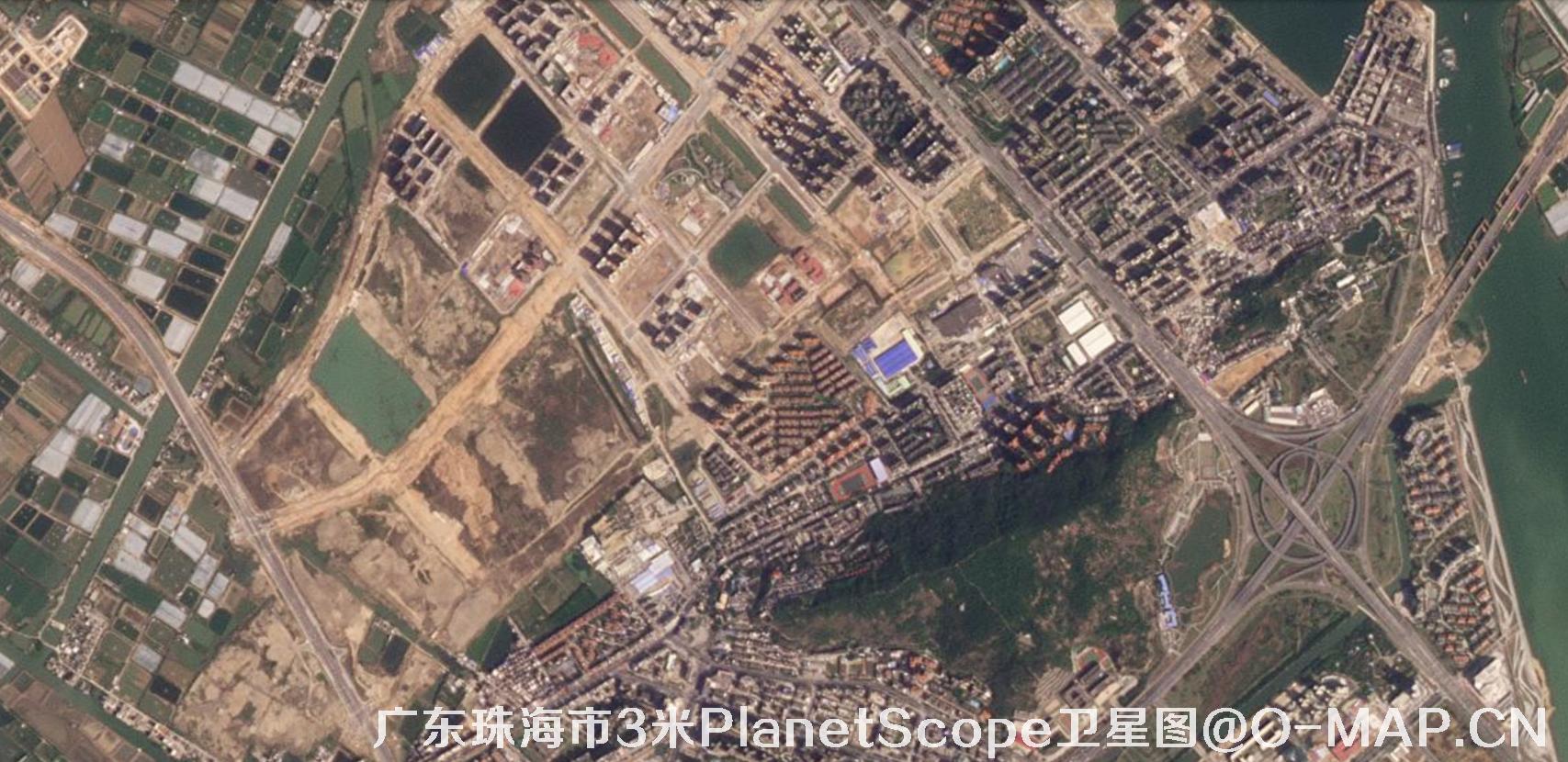
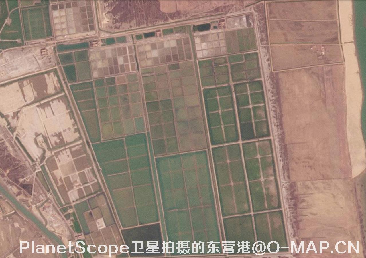
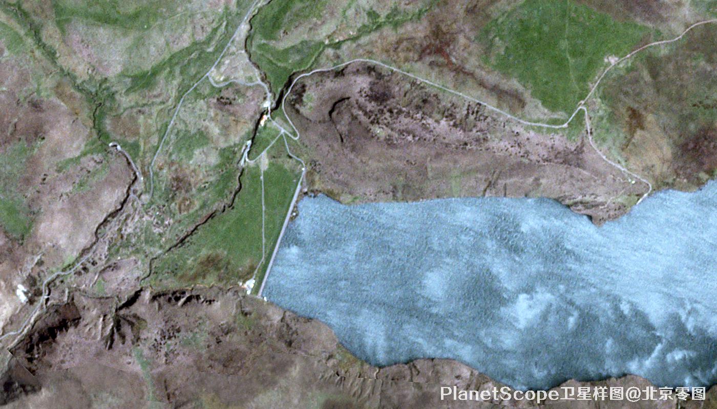
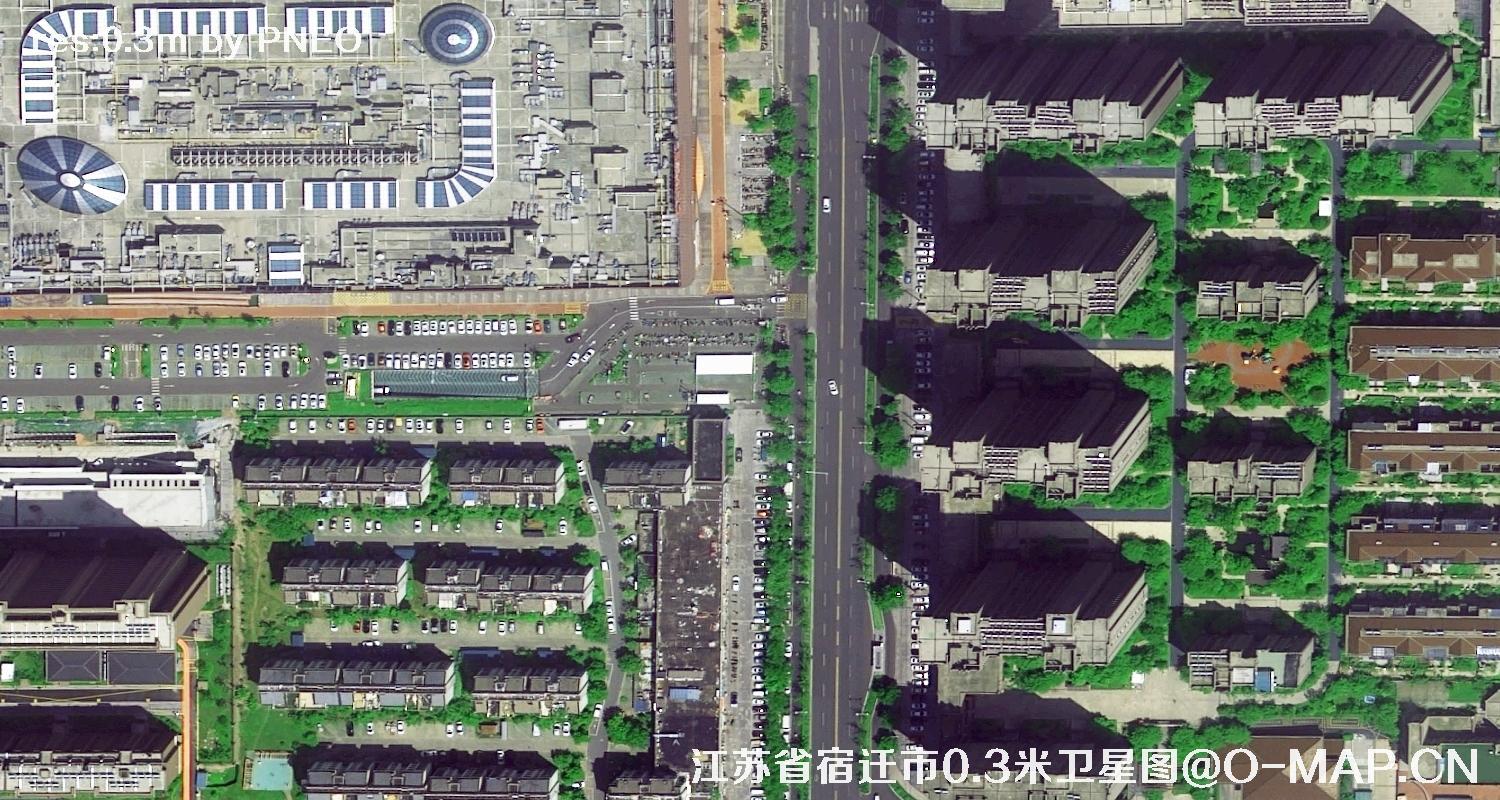
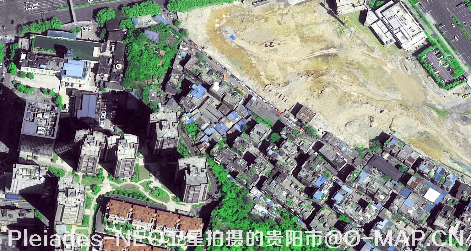
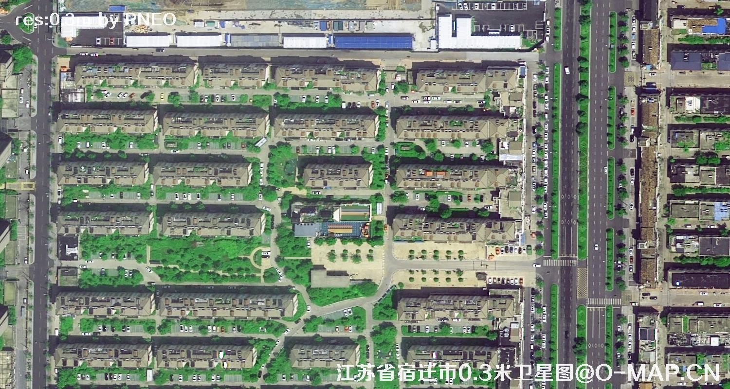
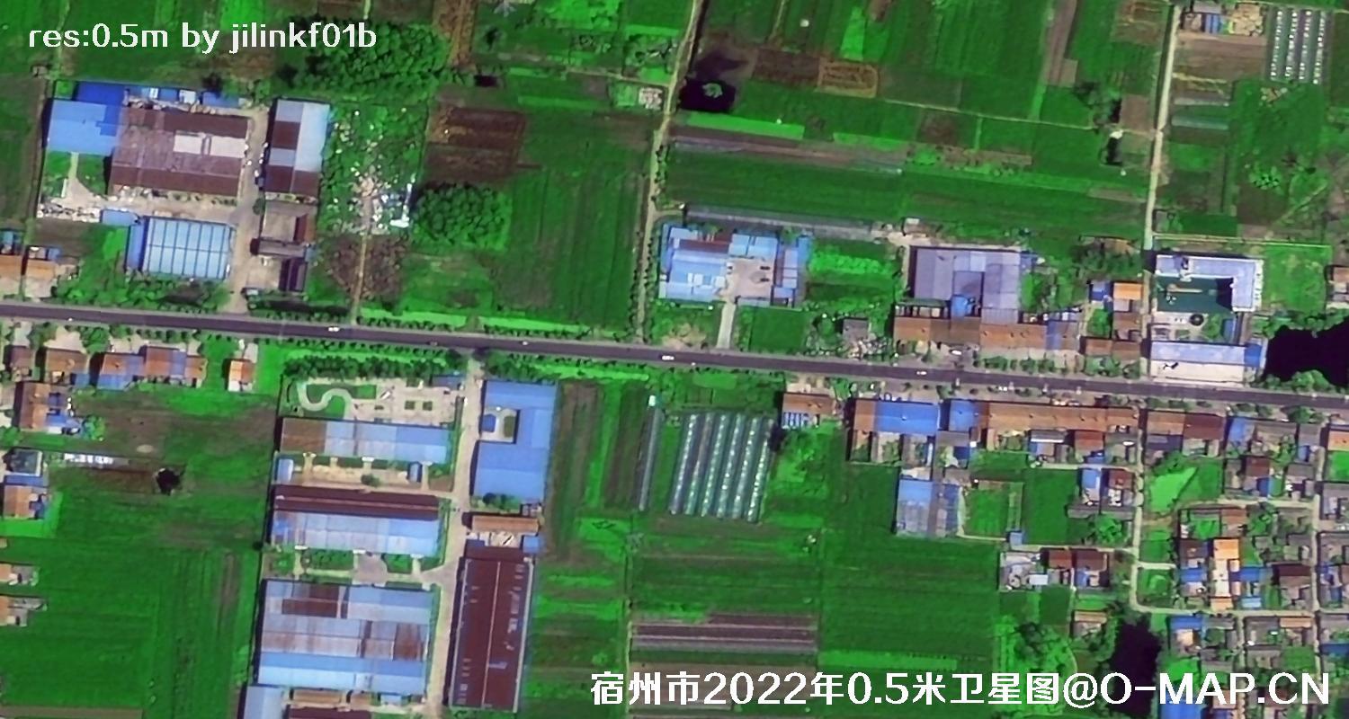
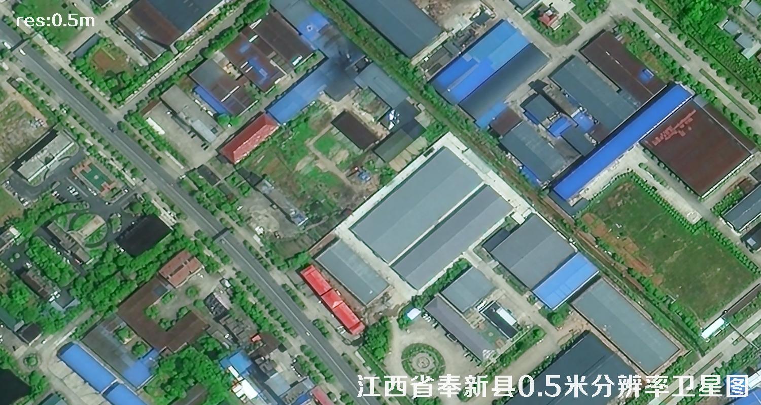
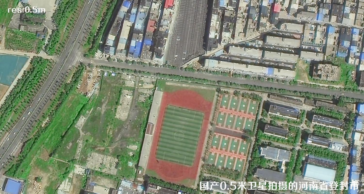
Sample of satellite images
Remarks: Satellite image is a digital product greatly influenced by the weather. Even the pictures taken by the same satellite will have some differences in definition and color, such as shooting angle (slight angle is better than large angle), shooting season (spring and summer are better than autumn and winter), and the weather, such as clouds (clouds are blocked, fog is blurred) and haze (foggy days reduce the definition and color of pictures), as well as the regional differences between the north and the south (the north is better than the south).
0.3-m Images by PNEO Satellite
0.5-m Images by Jilin Satellite
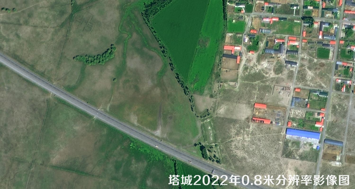
0.8-m Images by GF2 Satellite

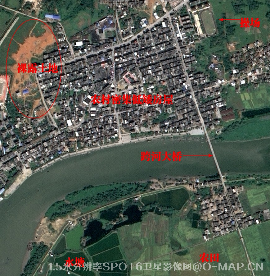
1.5-m Images by SPOT6 Satellite

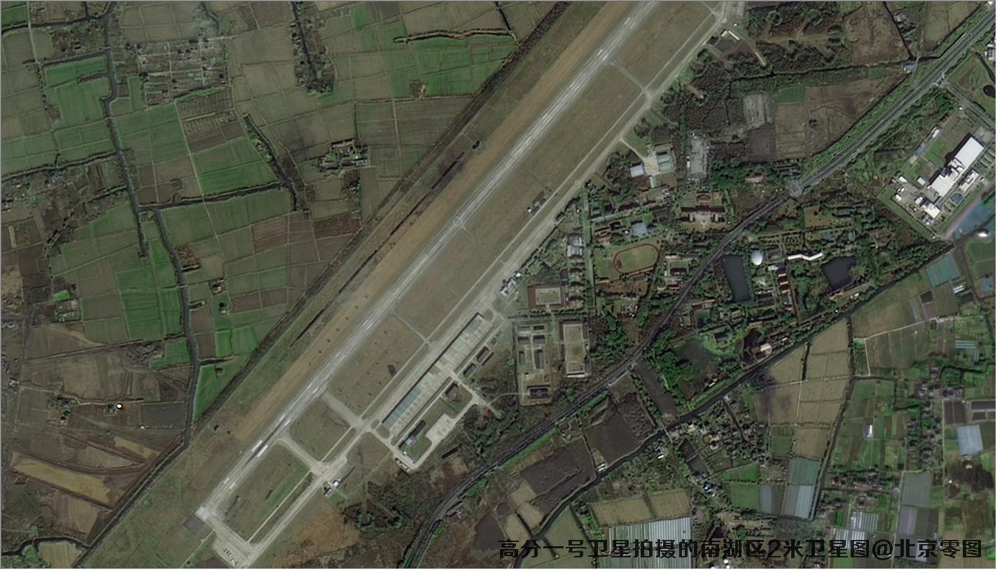
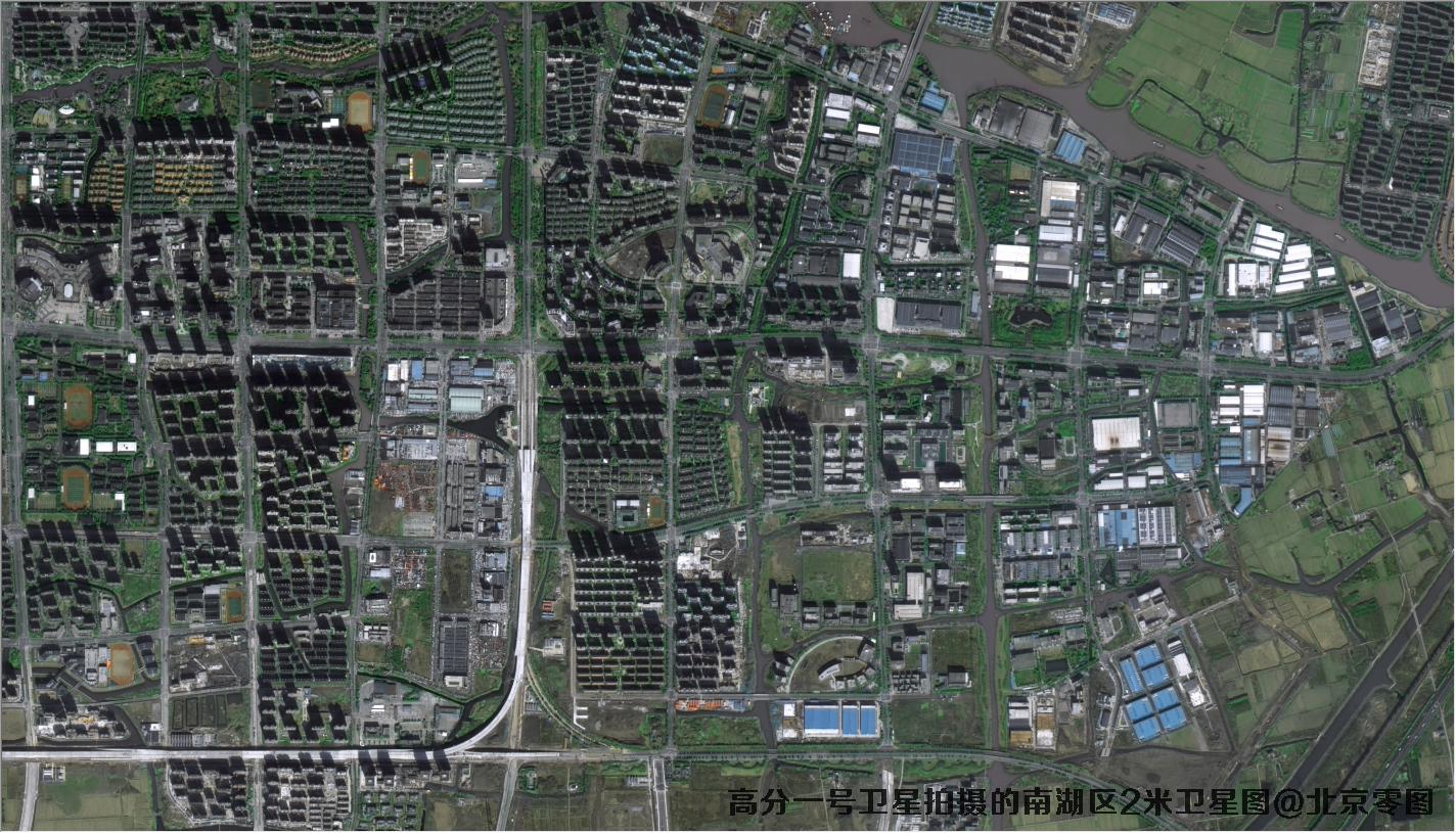
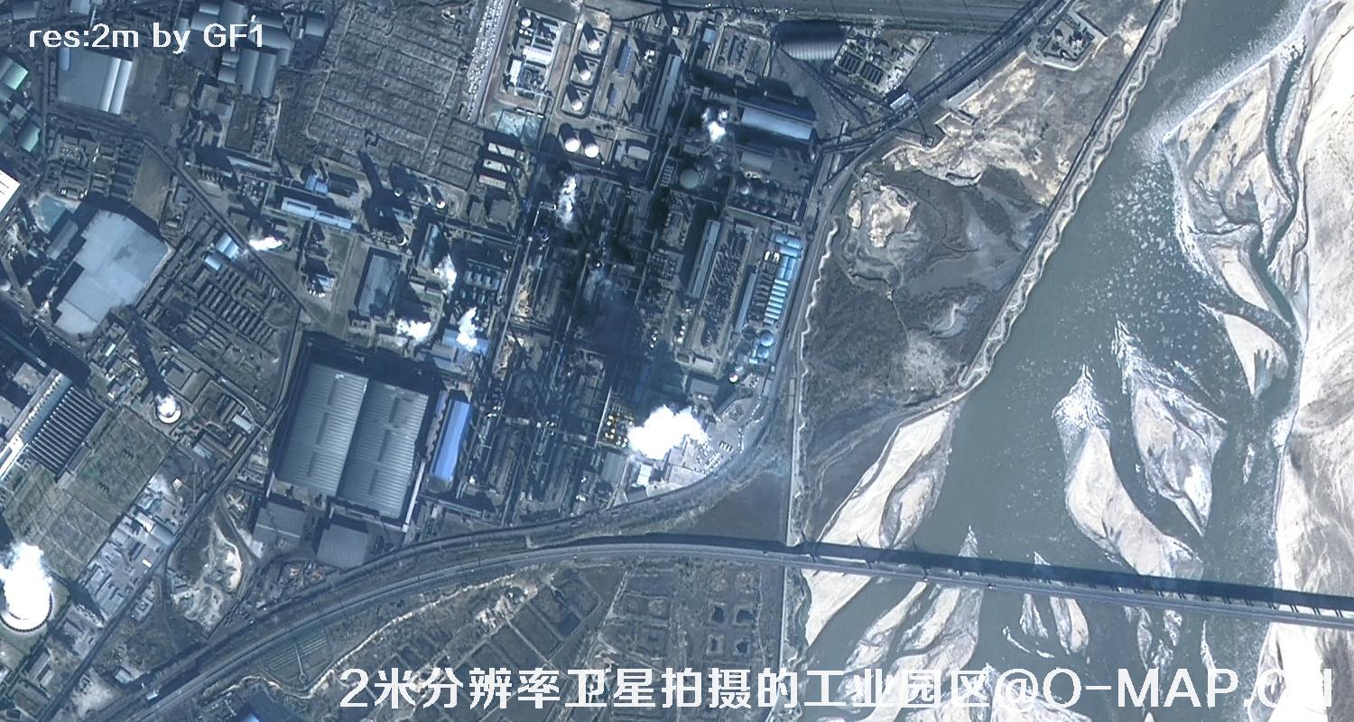
2-m Images by GF1 Satellite
4-m Images by Planet Satellite