
全国城市历史卫星图-各大城市九十年代历史卫星图
美国Landsat卫星拍摄的1990年的全国各大城市历史卫星影像图
以下图片是LandSat卫星TM传感器于1990年拍摄的全国各大城市的历史卫星图老照片,1990年的卫星技术还不是很先进,只能拍摄这种30-60米分辨率的卫星图,高清的卫星要在2000年以后才出现。购买历史卫星图请联系我方工作人员,查询其他区域历史卫星图可在线留言给我们。
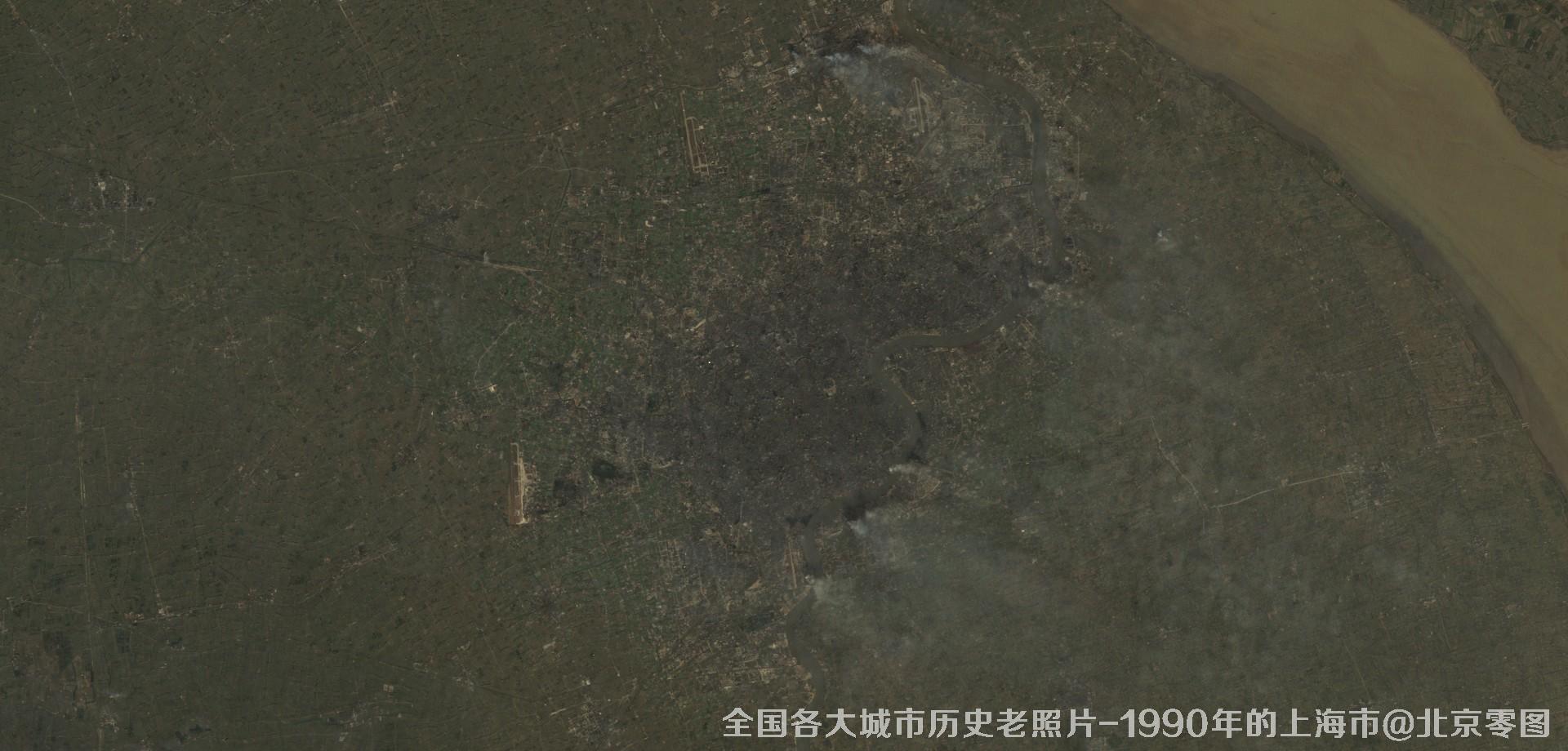
图1、美国Landsat卫星拍摄的1990年的上海市历史卫星影像图

图2、美国Landsat卫星拍摄的1990年的乌鲁木齐历史卫星影像图
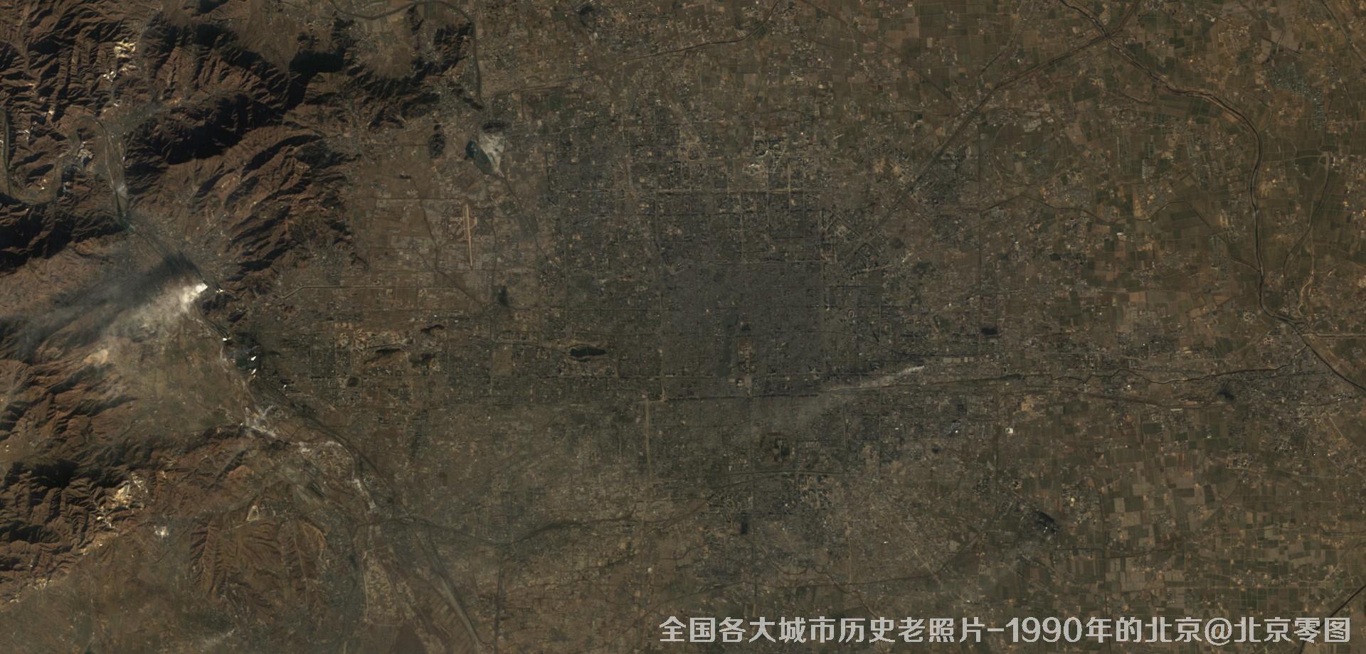
图3、美国Landsat卫星拍摄的1990年的北京市历史卫星影像图
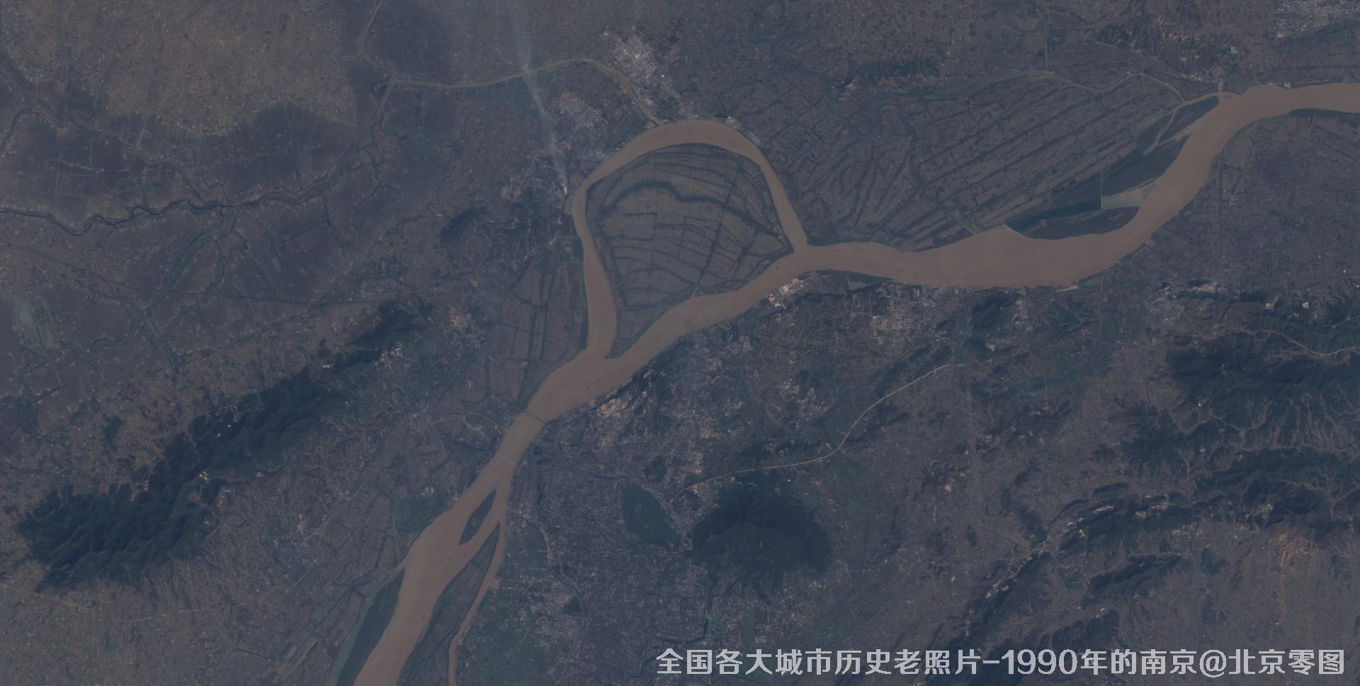
图4、美国Landsat卫星拍摄的1990年的南京市历史卫星影像图
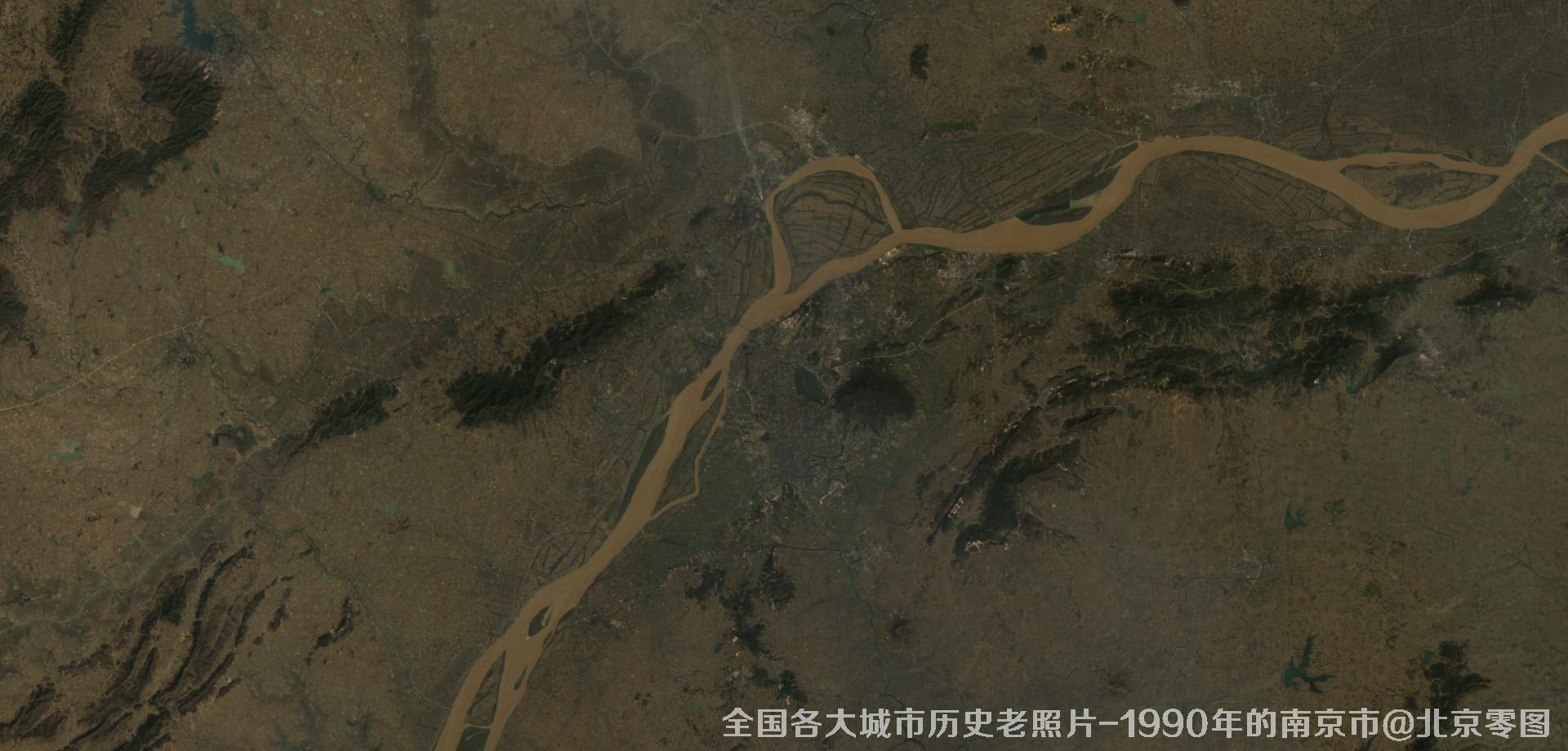
图5、美国Landsat卫星拍摄的1990年的江苏省南京市历史卫星影像图
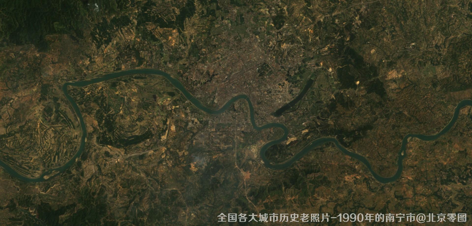
图6、美国Landsat卫星拍摄的1990年的广西省南宁市历史卫星影像图
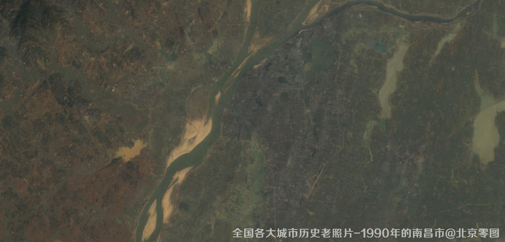
图7、美国Landsat卫星拍摄的1990年的江西省南昌市历史卫星影像图
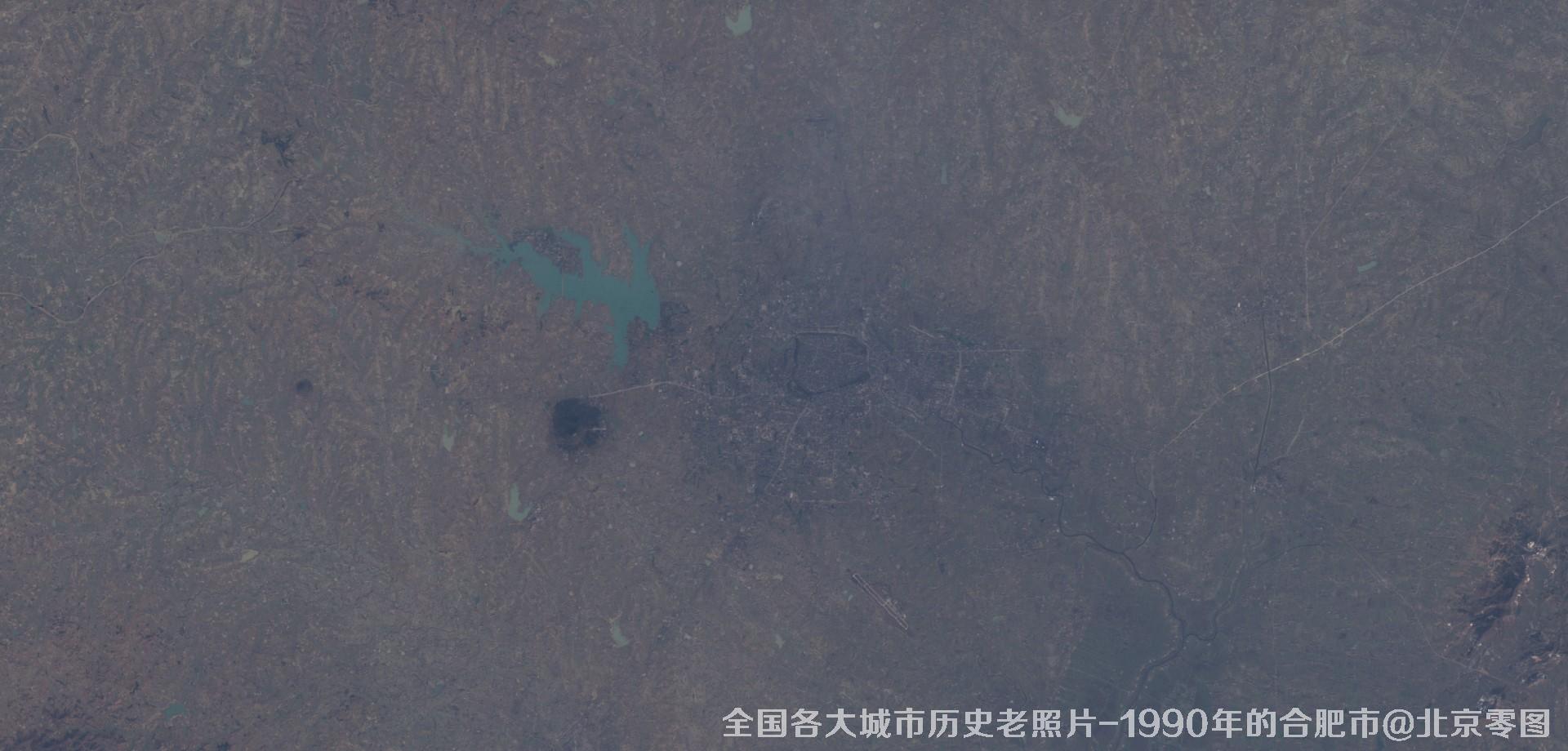
图8、美国Landsat卫星拍摄的1990年的安徽省合肥市历史卫星影像图
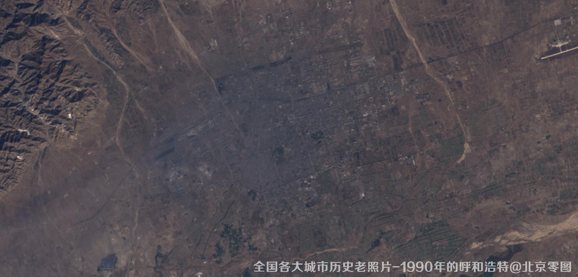
图9、美国Landsat卫星拍摄的1990年的内蒙古呼和浩特市历史卫星影像图
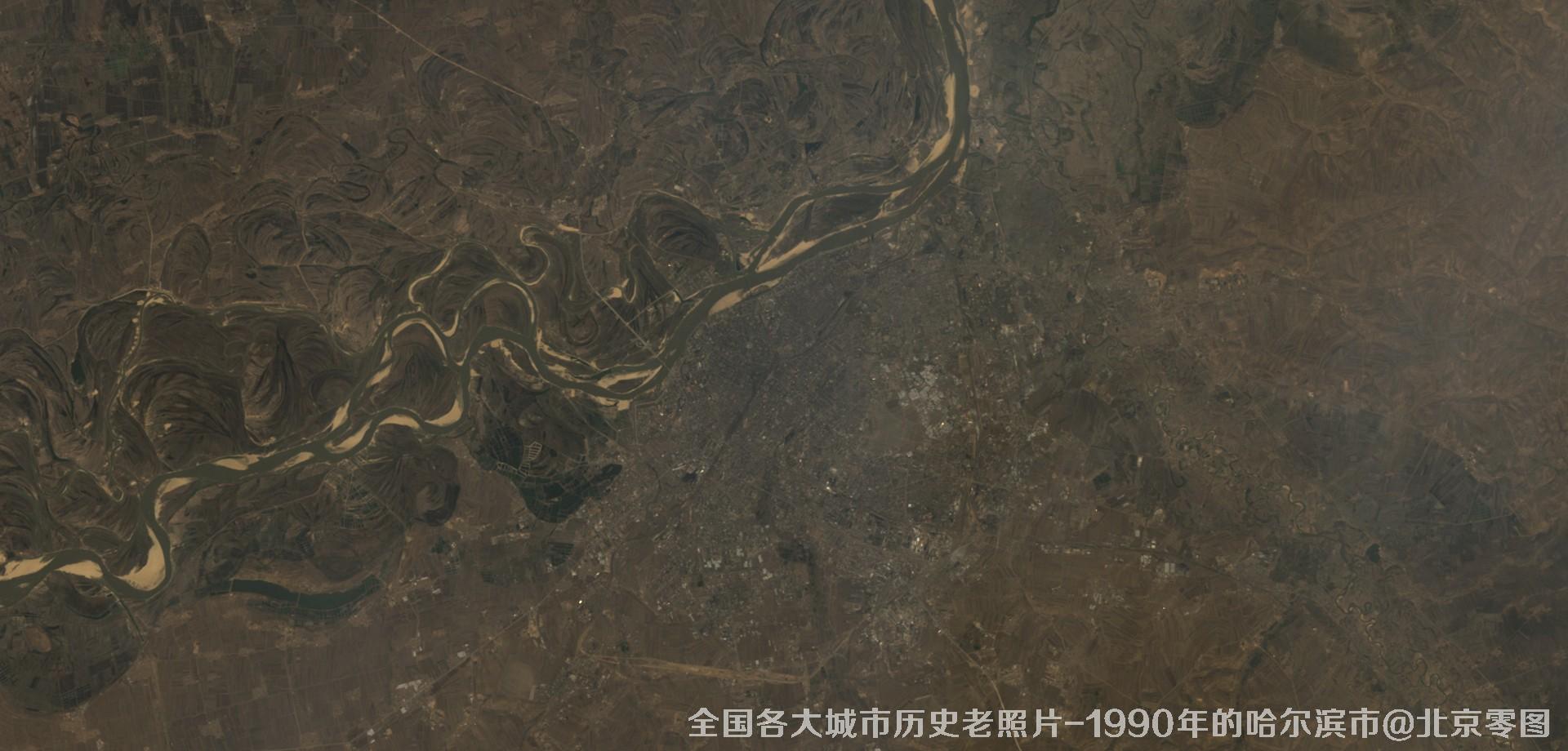
图10、美国Landsat卫星拍摄的1990年的黑龙江省哈尔滨市历史卫星影像图
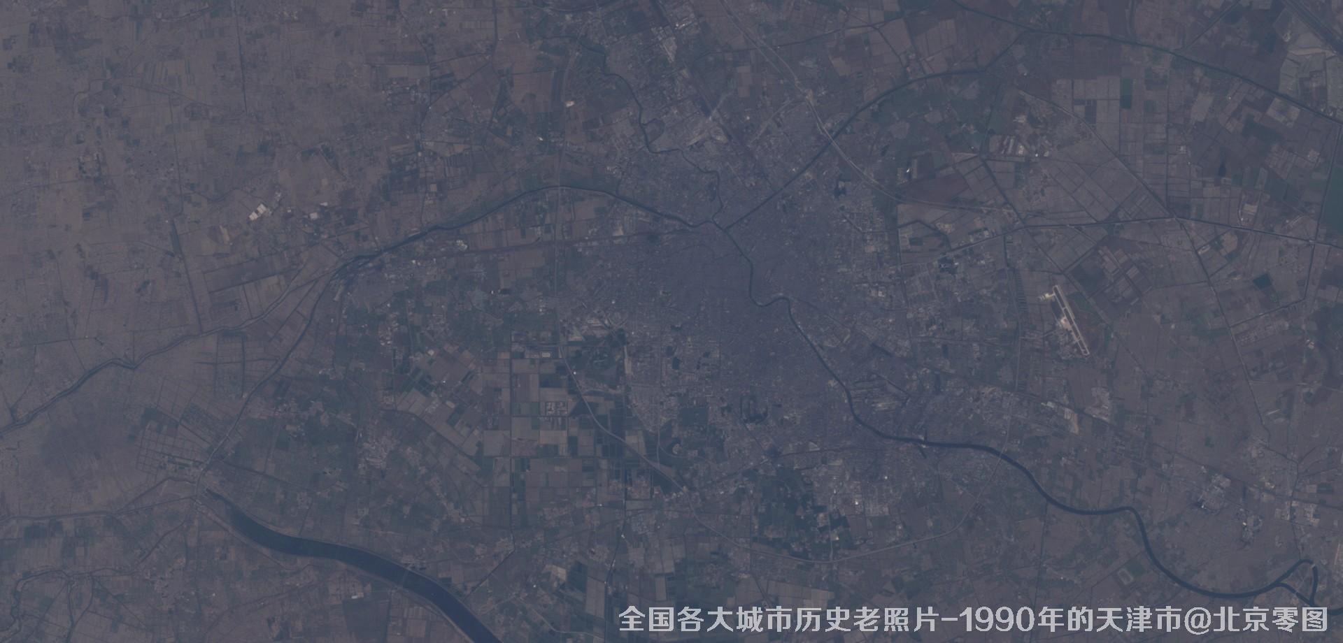
图11、美国Landsat卫星拍摄的1990年的天津市历史卫星影像图
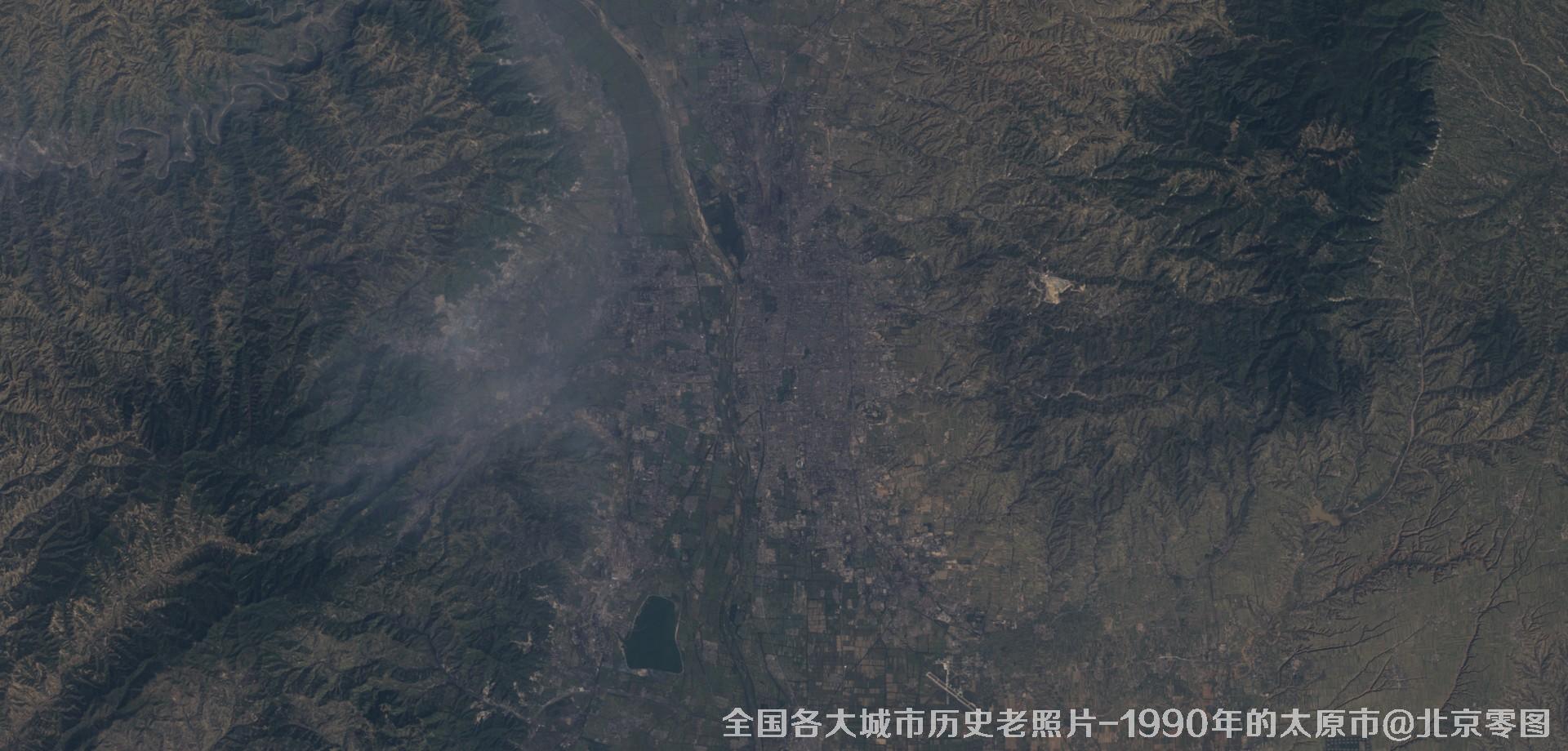
图12、美国Landsat卫星拍摄的1990年的山西省太原市历史卫星影像图
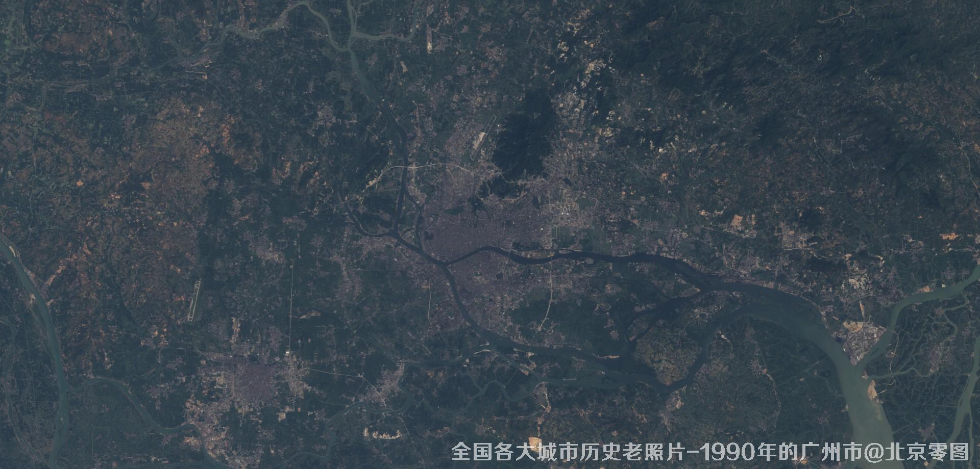
图13、美国Landsat卫星拍摄的1990年的广东省广州市历史卫星影像图
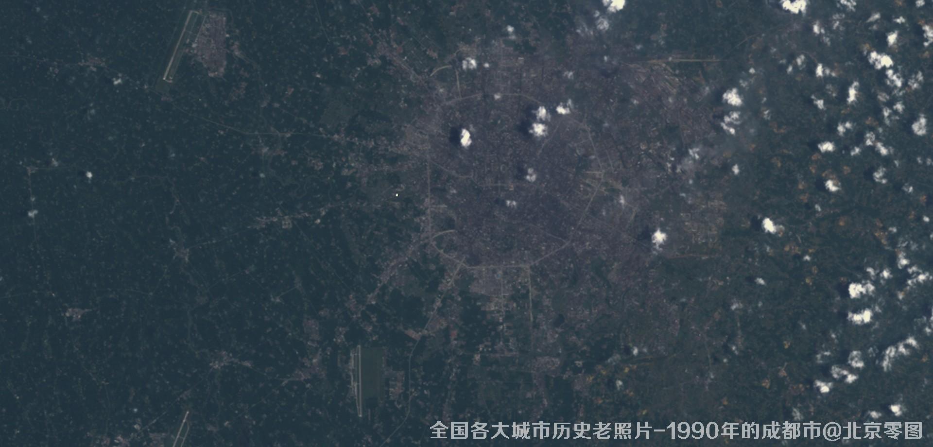
图14、美国Landsat卫星拍摄的1990年的四川省成都市历史卫星影像图
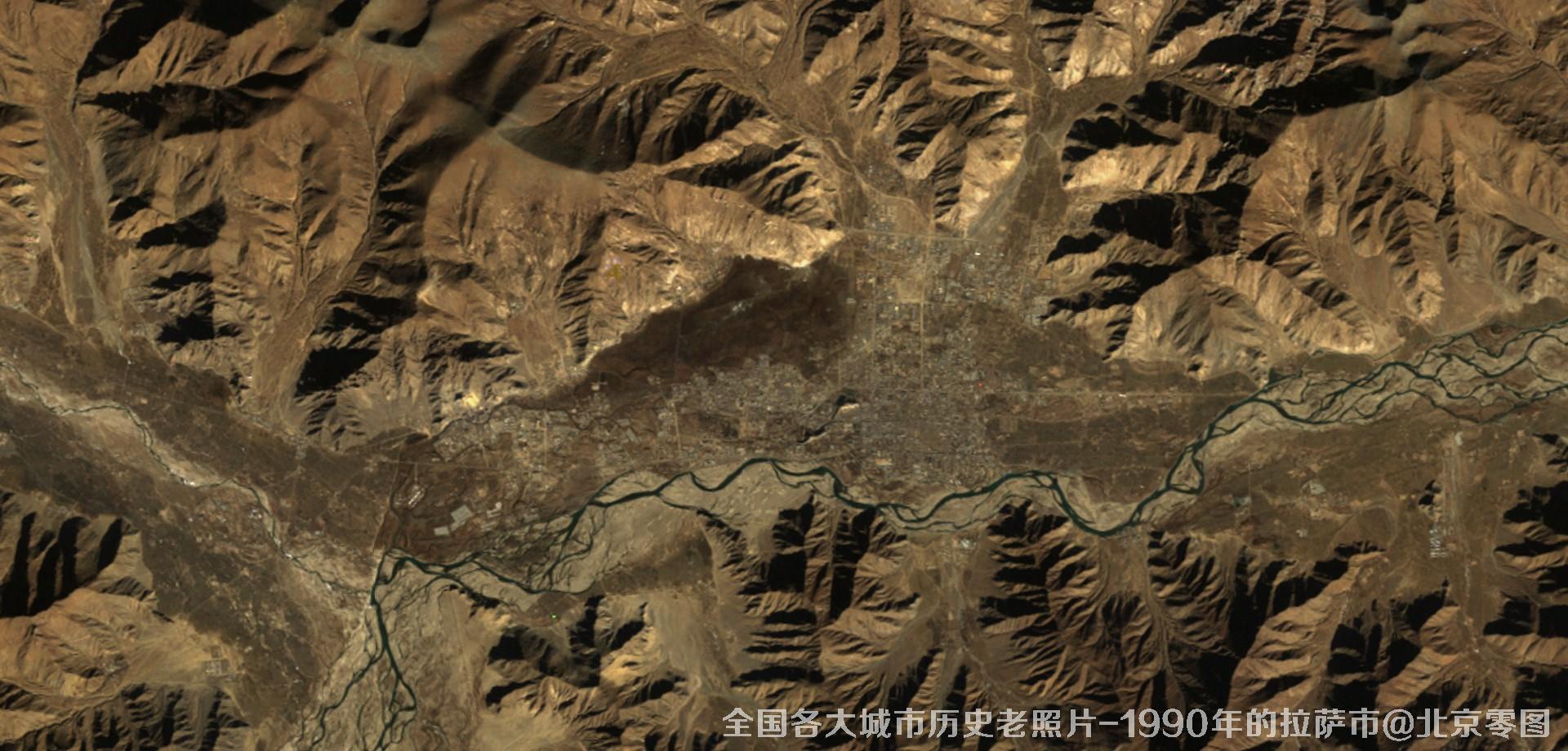
图15、美国Landsat卫星拍摄的1990年的西藏拉萨市历史卫星影像图
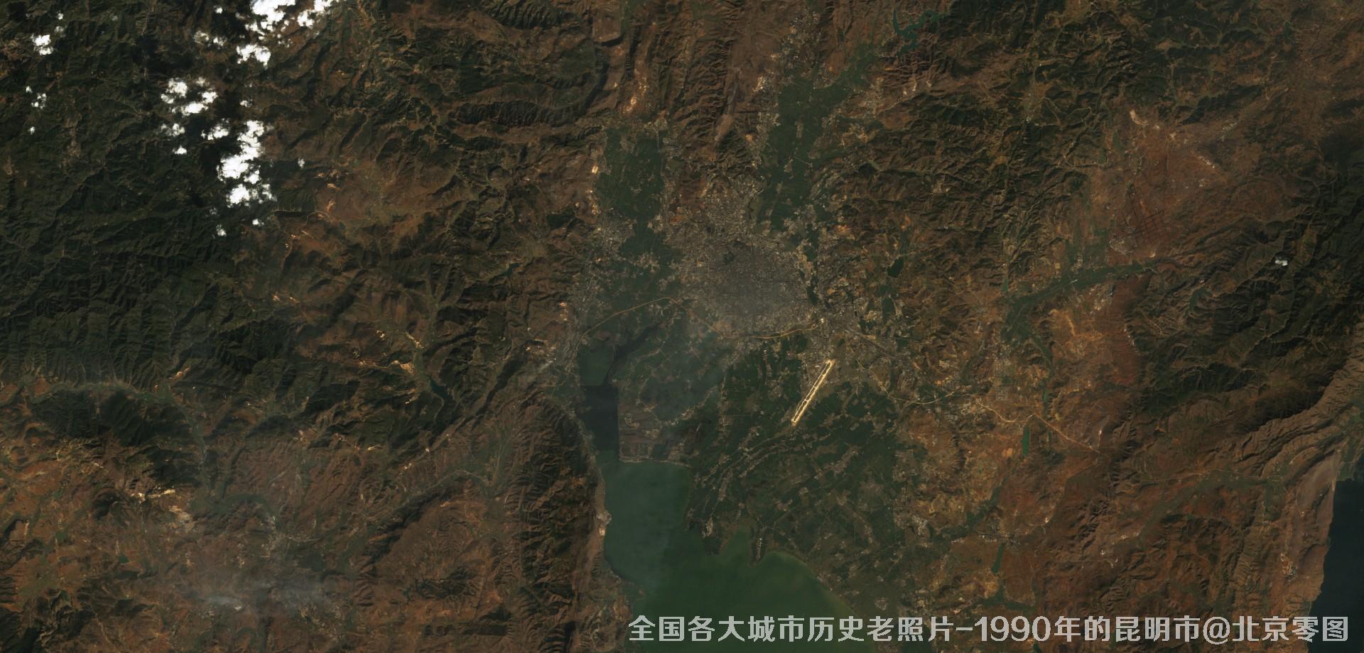
图16、美国Landsat卫星拍摄的1990年的云南省昆明市历史卫星影像图
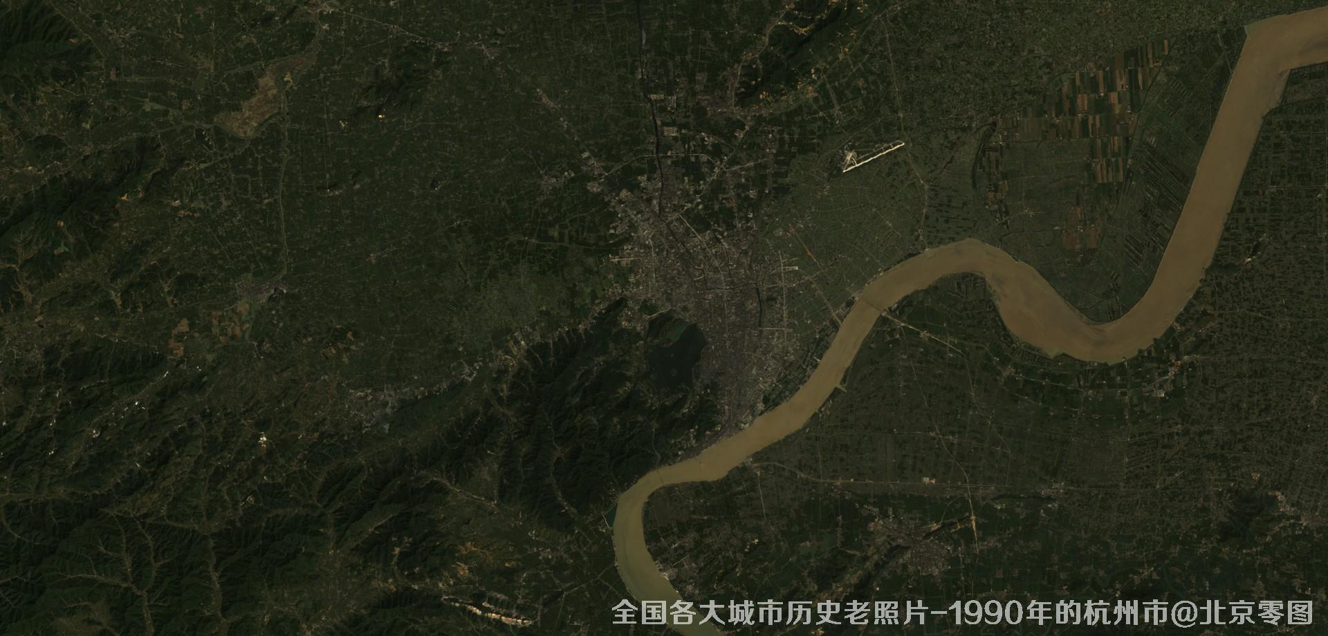
图17、美国Landsat卫星拍摄的1990年的江苏省杭州市历史卫星影像图
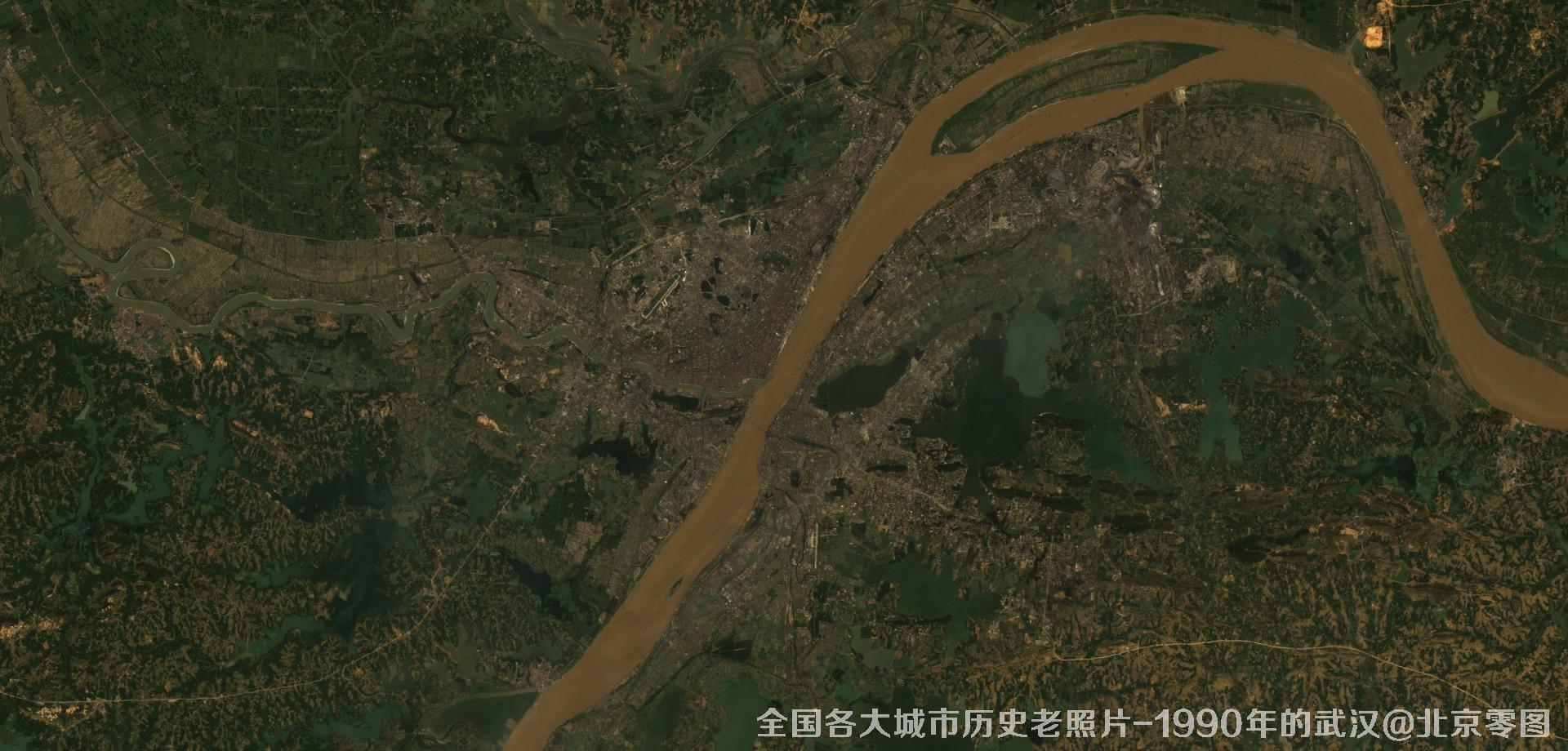
图18、美国Landsat卫星拍摄的1990年的湖北省武汉市历史卫星影像图
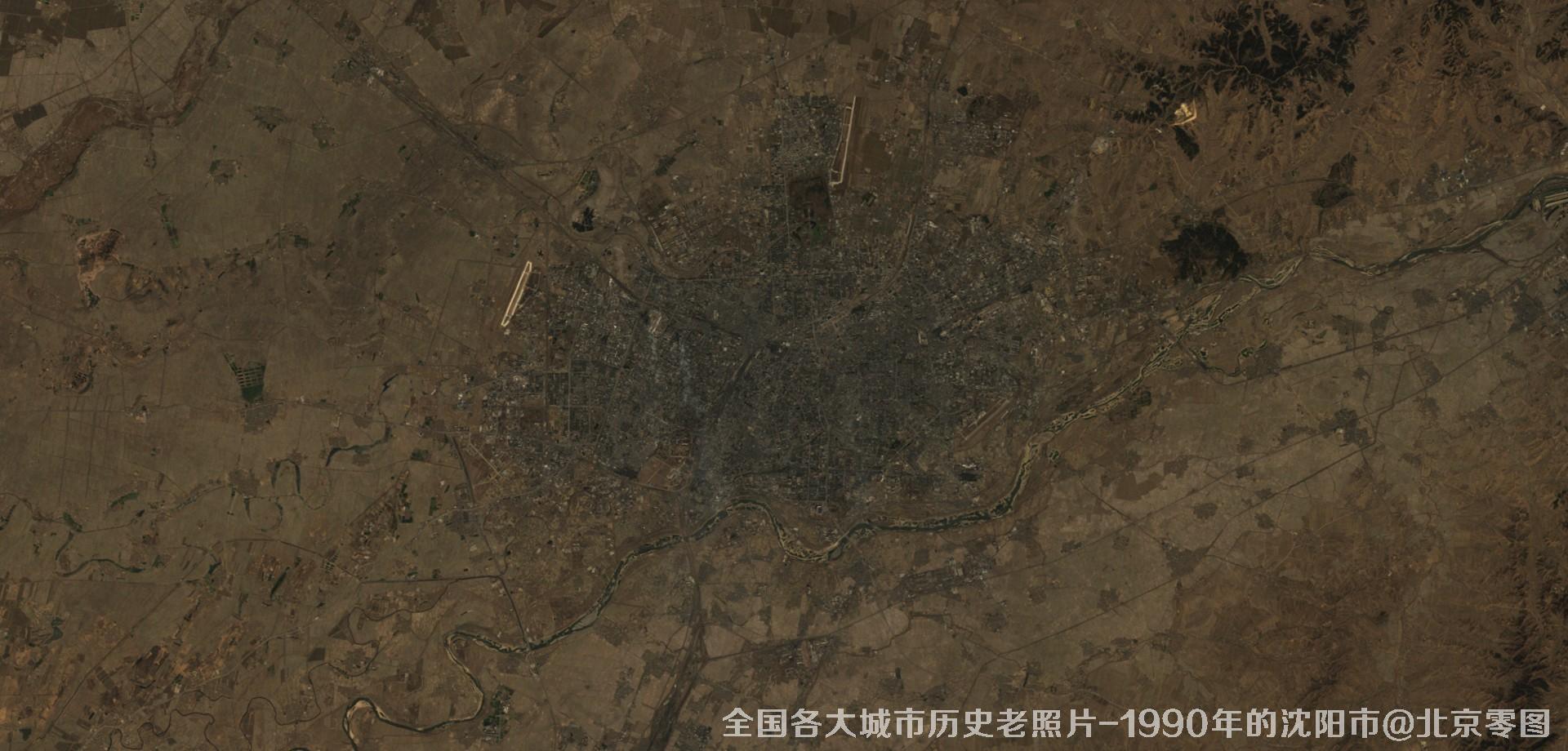
图19、美国Landsat卫星拍摄的1990年的辽宁省沈阳市历史卫星影像图
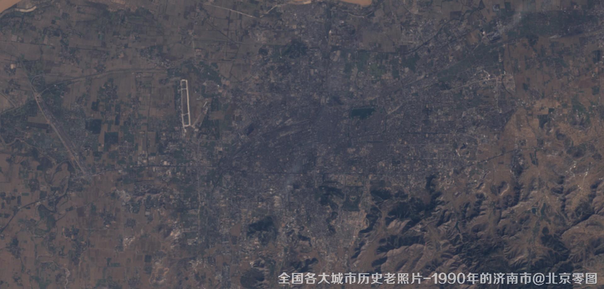
图20、美国Landsat卫星拍摄的1990年的山东省济南市历史卫星影像图
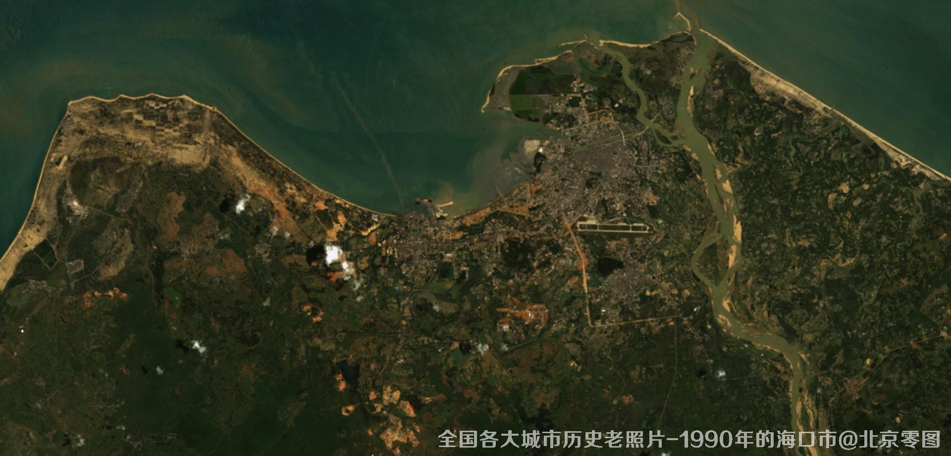
图21、美国Landsat卫星拍摄的1990年的海南省海口市历史卫星影像图
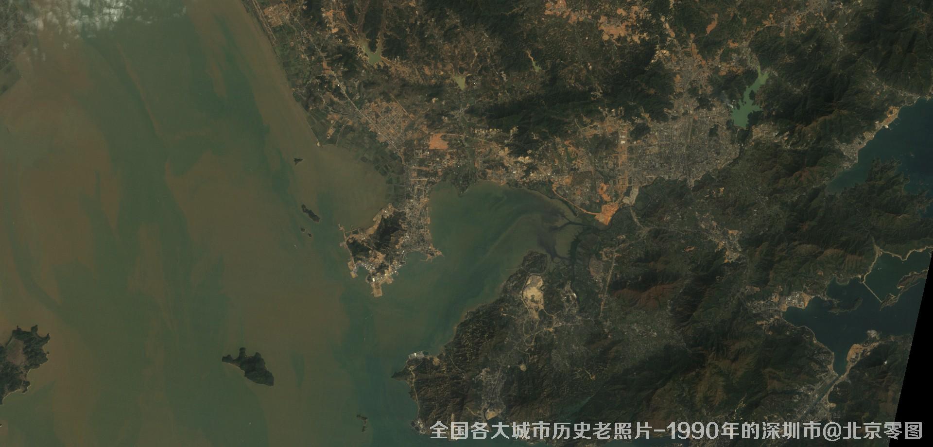
图22、美国Landsat卫星拍摄的1990年的广东省深圳市历史卫星影像图
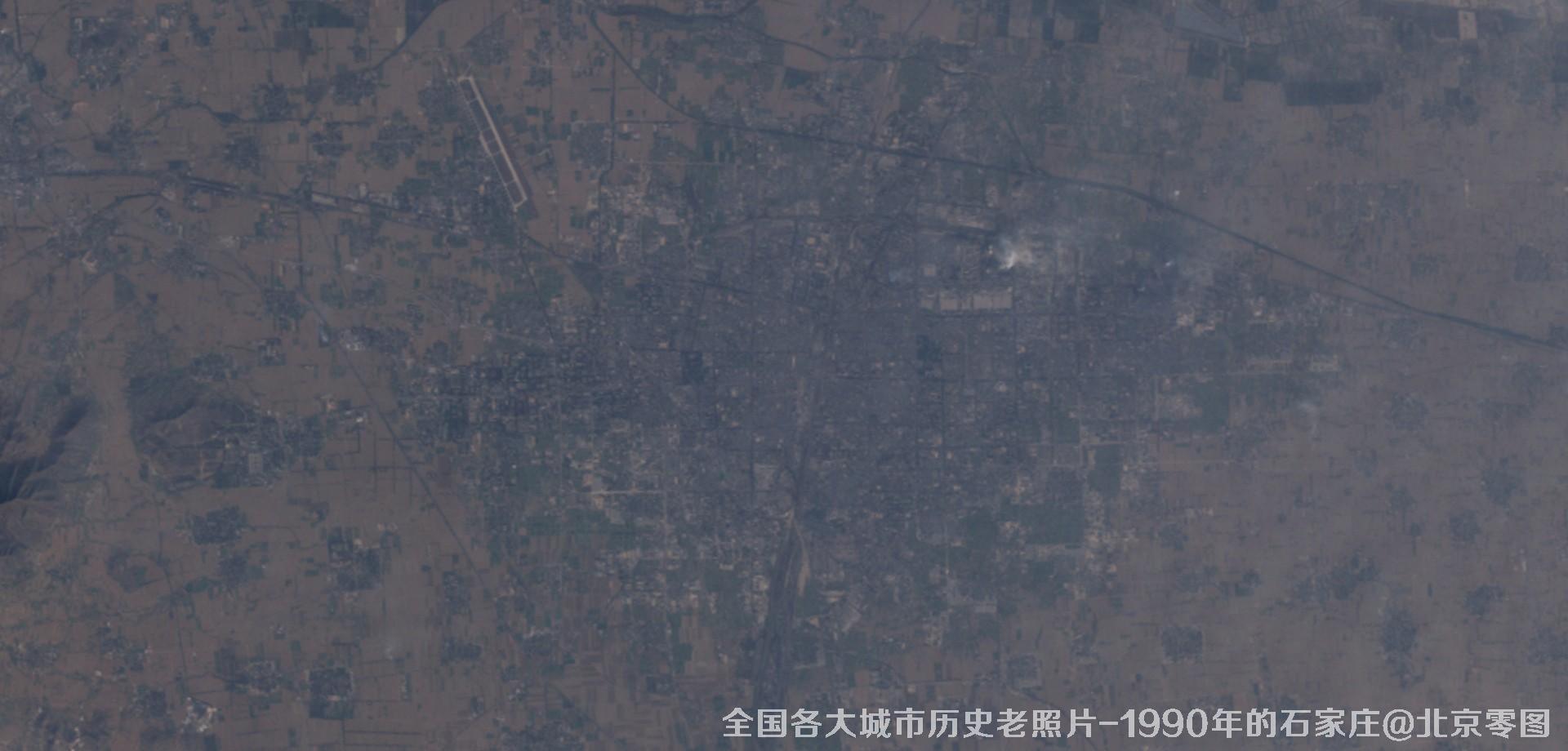
图23、美国Landsat卫星拍摄的1990年的河北省石家庄市历史卫星影像图
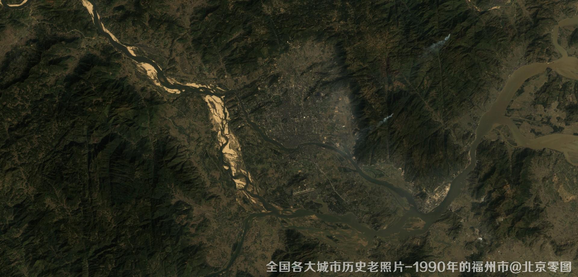
图24、美国Landsat卫星拍摄的1990年的福建省福州市历史卫星影像图
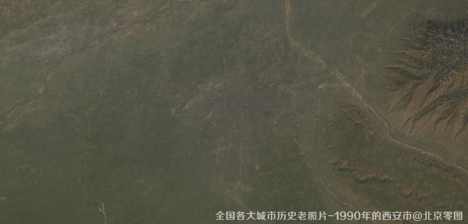
图25、美国Landsat卫星拍摄的1990年的陕西省西安市历史卫星影像图
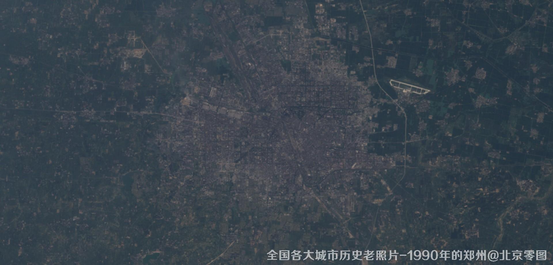
图26、美国Landsat卫星拍摄的1990年的河南省郑州市历史卫星影像图
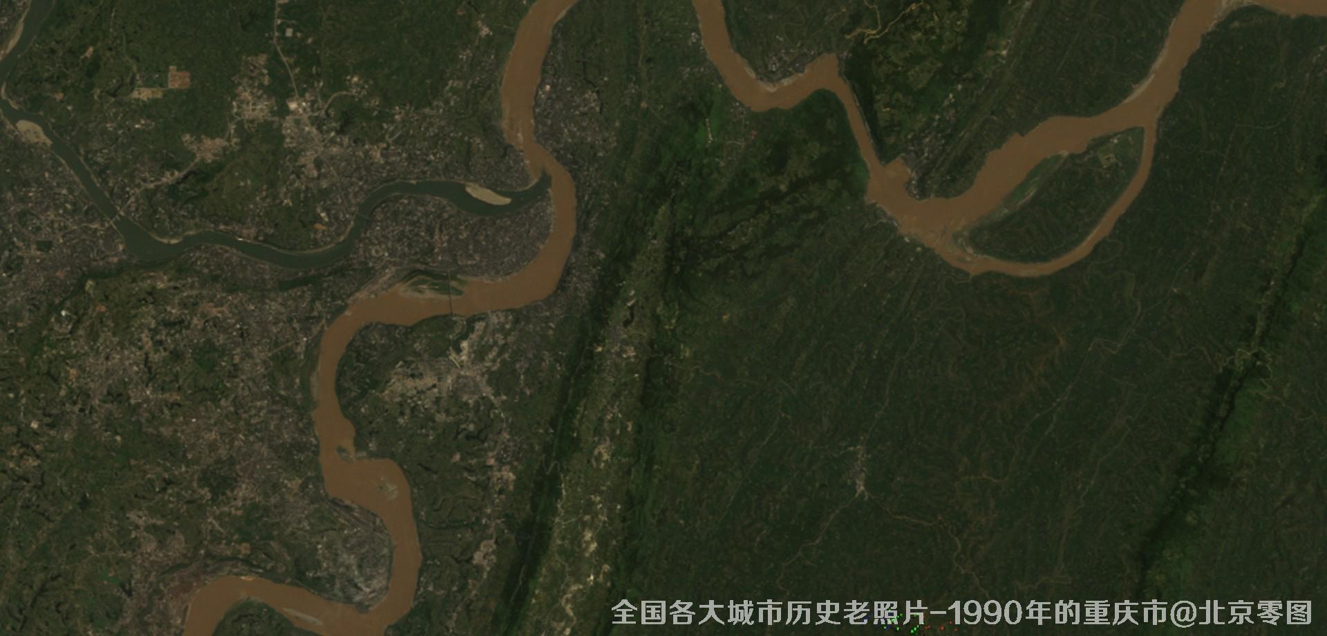
图27、美国Landsat卫星拍摄的1990年的重庆市历史卫星影像图
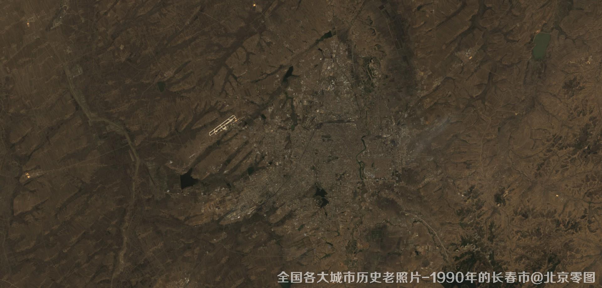
图28、美国Landsat卫星拍摄的1990年的吉林省长春市历史卫星影像图
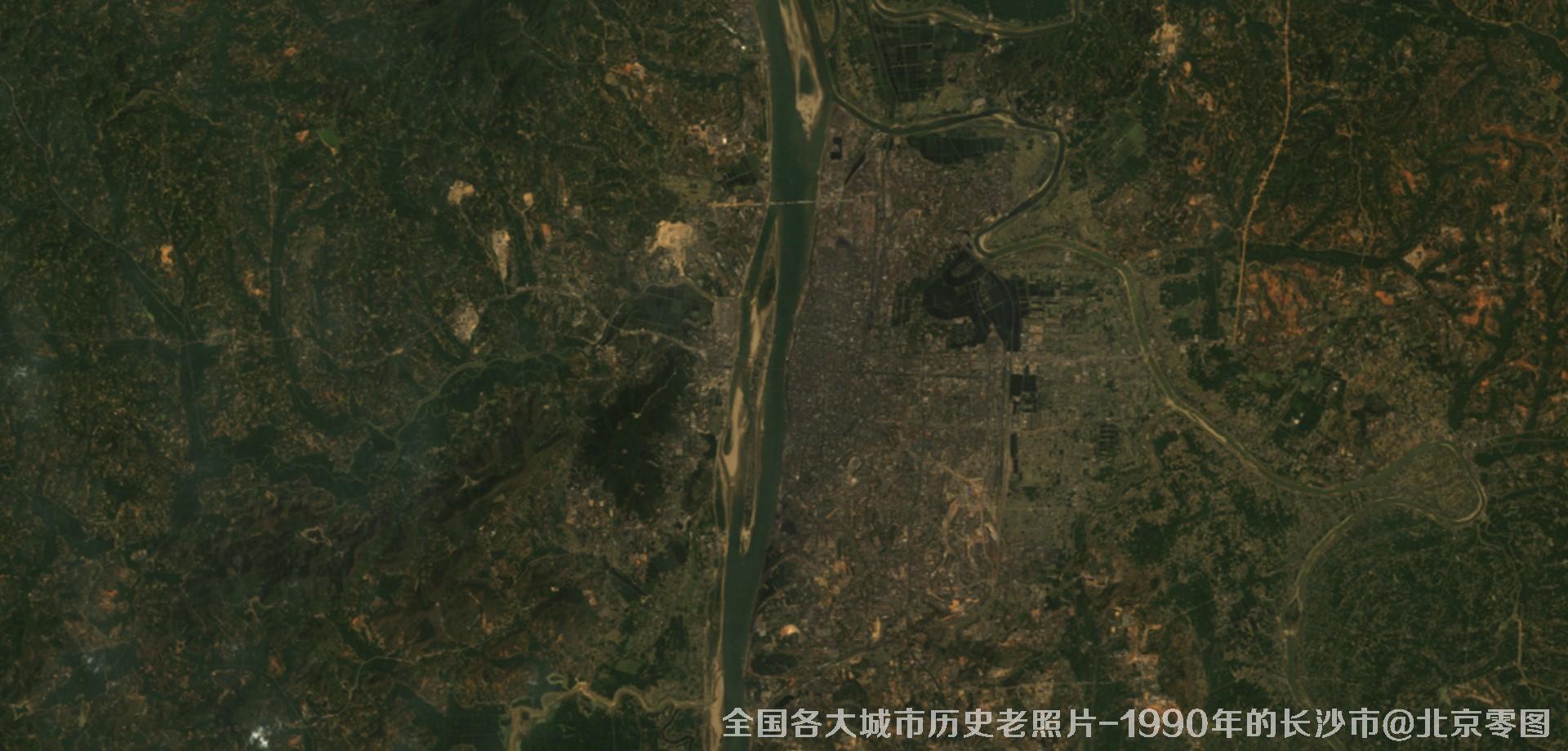
图29、美国Landsat卫星拍摄的1990年的湖南省长沙市历史卫星影像图
如需购买以上卫星影像数据请联系我方销售人员起草合同并开具发票,合同生效后5-10个工作日内交付影像数据,卫星影像实际效果可参考文末样图。
如果本文对您有帮助,不要忘记收藏和分享哦