SuperView-1 (Gaojing-1) – Purchase Parameters & Sample Imagery

πŸ“… Published: July 8, 2023 ✍️ Source: Original article (reproduction prohibited) πŸ›°οΈ Satellite: SuperView
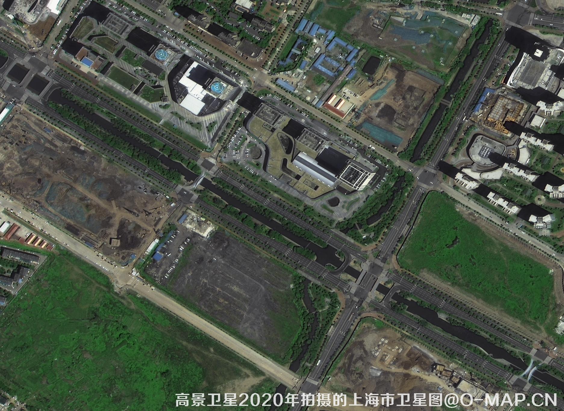
Abstract: Gaojing (SuperView) satellite, also known as Gaojing-1 (SuperView-1), is China's first 0.5-meter-resolution commercial satellite. Launched in 2017, it provides nationwide 0.5-m satellite remote-sensing imagery in China from 2017 to the present, with an average refresh of every 2–3 months. Below are the purchase parameters of the SuperView satellite plus selected sample images. To purchase SuperView imagery, please contact the staff of Beijing Yijingtu (contact us), and click Search Online to view more satellite project cases.
πŸ₯‡
China's first 0.5 m commercial satelliteSuperView-1 pioneered 0.5-m high-resolution optical imaging for China's commercial market.
πŸ—“οΈ
Archive: 2017 – presentNationwide coverage available; ideal for change detection and historical comparison.
πŸ”„
Refresh every 2–3 monthsHigh revisit capability supports monitoring, planning and rapid tasking.
🎯
Tasking supportedNew programming / custom acquisition available; mono & stereo pairs offered.

πŸ“‹ SuperView Satellite Parameter Table

🌍 CountryChina
🏒 OperatorChina Aerospace Science and Technology Corporation (CASC)
πŸš€ Launch dateDecember 28, 2016
πŸ›°οΈ Satellite typeOptical remote-sensing satellite
πŸ” Resolution0.5 m panchromatic + 2 m multispectral
🌈 Spectral bandsPan + 4-band multispectral (Blue, Green, Red, NIR)
↔️ Swath width12 km
πŸ“¦ Product typesMono, stereo pairs
πŸ“‘ Custom taskingSupported (programmable acquisition)
βœ… Status● Operating normally in orbit
πŸ–ΌοΈ Sample imageryClick to view
πŸ“„ Datasheetsuperview.pdf

πŸ“Š Resolution comparison (smaller = sharper)

SuperView Pan 0.5 m
0.5 m
SuperView MS 2 m
2 m
GF-1 / ZY typical 2 m
2 m
Medium-res 10 m
10 m
Pan Blue Green Red NIR

πŸ’‘ 0.5-m imagery clearly shows buildings, vehicles, roads and airport facilities β€” suitable for mapping, planning, enforcement evidence and landscape overviews.

βš™οΈ At a glance

↔️ 12 km swath  Β·  πŸ”„ 2–3-month update  Β·  πŸ“‘ Taskable
🧊 Products: Mono / Stereo  Β·  βœ… In-orbit, healthy

πŸ›’ Buy SuperView Satellite Imagery


Disclaimer: this is an original article. Reproduction without permission is prohibited; violators will be held liable.

πŸ›°οΈ About Beijing Yijingtu Geoinformation Technology Co., Ltd.

Beijing Yijingtu Geoinformation Technology Co., Ltd. (β€œBeijing Yijingtu”), based in Chaoyang District, Beijing, is a well-known satellite-map service provider in China.

We mainly provide domestic 1–3 m resolution remote-sensing image & map data, including historical imagery from the 1960s–1980s and post-2015 Gaofen-series satellite imagery.

  • πŸ’° Pricing is by area/scene: domestic imagery typically Β₯1–30 / kmΒ², averaging about Β₯500–3,000 per scene (final price depends on area, resolution, date, product level and processing; higher-resolution options ~Β₯100–500 / kmΒ²).
  • πŸ“„ Formal purchase contract + invoice provided. Standard delivery in 5–10 working days; rush orders can be delivered the same day.
  • ✨ Value-added services: wall-map production, automatic land-cover classification (forest / farmland / water / roads / buildings / open land), bare-soil monitoring, 3D white models, building-vector extraction, change detection (image or video), evidence-ready cartography, place-name labeling, style beautification and HD super-resolution.

To inquire about or purchase satellite imagery, please contact our staff / leave a message, search online for more project cases and samples, or visit our news pages for satellite guides and industry updates.

πŸ“ž Contact Us

πŸ“ Location: Chaoyang District, Beijing, China

πŸ’¬ Data inquiry (WeChat): xdj_jl

πŸ“ž Sales manager: 13301238517

βœ‰οΈ Email: accpxdj@gmail.com

πŸ”— Website: Beijing Yijingtu Official Site

Β© 2021–2026 Beijing Yijingtu Geoinformation Technology Co., Ltd. All rights reserved.
δΊ¬ICP倇2021039670号-1