⏱ AcquisitionOctober 2026
📍 LocationNumrug Nature Reserve, Mongolia
🎯 ApplicationFire monitoring and disaster assessment
In early October 2026, a catastrophic grassland fire broke out in the Numrug Nature Reserve on Mongolia's eastern border. According to Mongolian media and Xinhua, the fire was directly linked to Japanese-side activities: a group of 10+ people in 5 vehicles from MobiCom Corporation — the Mongolian telecom operator controlled by Japanese telecom operator KDDI Corporation (KDDI, 凯迪迪爱) entered the Strictly Protected Area, including several Japanese executives; dry grass was ignited while the vehicles were moving, triggering the blaze. This is now the main cause identified by investigators.
🇯🇵 How the Japanese side caused the fire — timeline: On Oct. 8, the MobiCom convoy entered the core grassland without adequate fire precautions during extreme drought and gale conditions; high-temperature exhausts and tire friction ignited withered grass, and force-7 winds created multiple fire fronts. Open flames were not extinguished until Oct. 16. On Oct. 20, KDDI admitted the fire was related to activities of its subsidiary MobiCom's Japanese executives; on Oct. 23 it apologized on its website but insisted there was "no illegal conduct", drawing strong criticism. Mongolia's Deputy Prime Minister Nomtaibayar said "an apology alone is not enough" and the government will investigate and consider compensation claims. See Xinhua: Mongolia considers claiming compensation from Japanese firm and People.com: same report.
The blaze passed through ignition, outbreak, out-of-control spread, firefighting and re-ignition phases. Rangers reported it promptly, but remoteness and water shortage hampered heavy equipment, and the area expanded tenfold in 48 hours. Over 300 firefighters and 2 helicopters fought for nearly a week before open flames were extinguished.
High-resolution interpretation (Fig.1) shows an irregular elliptical scar, 90 km north-south by 81 km east-west, totaling over 5,500 sq km. Grasslands, shrub forests and valley wetlands were destroyed, wildlife habitats devastated and winter pastures lost — described locally as the worst in a decade.
Investigations blamed missing firebreaks and delayed warning. Those responsible were held accountable, and Mongolia will fund fire lanes, watchtowers and stricter border fire control.
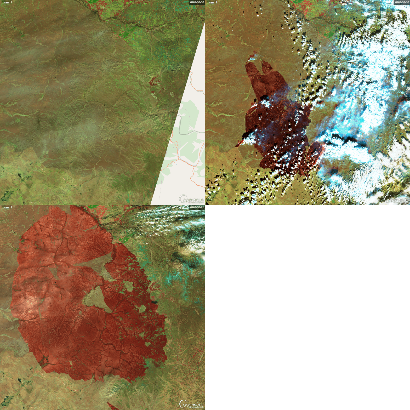
Satellite imagery was decisive. Pre/post multi-temporal comparison (Fig.2) quickly delineated the perimeter, classified burn severity and assessed vegetation and soil loss, supporting rescue, reconstruction and restoration. That is the core value of remote sensing for fire monitoring and post-disaster assessment: wide, fast and objective.
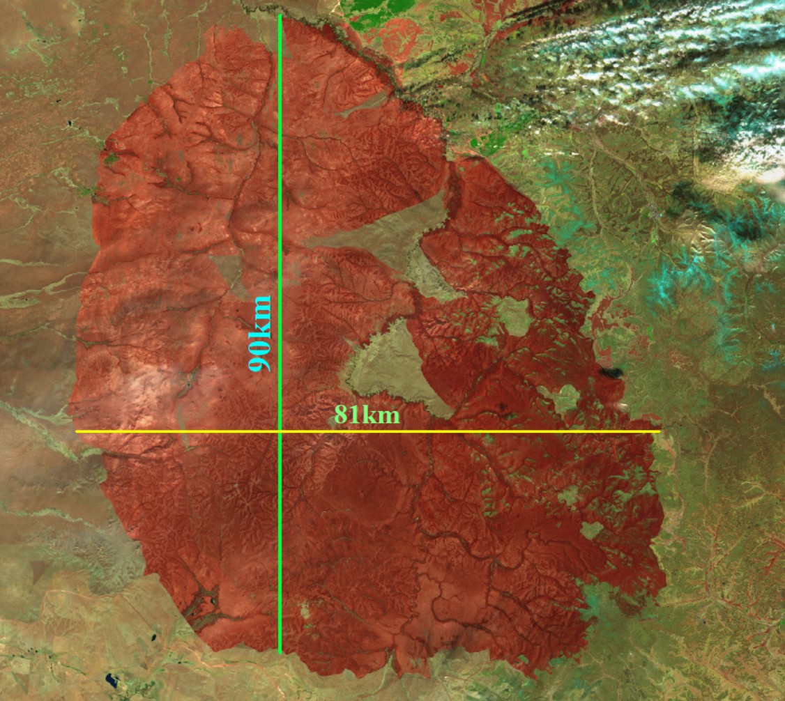
🛰️ Numrug Strictly Protected Area Fire Satellite Images
The before/after comparison shows green vegetation turning black with smoke traces — dense pre-fire grassland versus scorched post-fire earth.