🛰Tsinghua University - Satellite View of the World
🏫About Tsinghua University
Founded in 1911 as Tsinghua Academy, Tsinghua University is one of China's most prestigious universities. Guided by its motto of “Self-discipline and Social Commitment”, it has nurtured generations of outstanding talent. Century-old landmarks such as the Grand Auditorium and the Old Gate stand alongside modern teaching and research complexes, where tradition meets the future.
The campus sits in Zhongguancun, Haidian District, Beijing, west of the Old Summer Palace ruins, covering about 442 hectares. Xuetang Road divides it into east and west zones: the west is famed for the Jinchun Garden and Shuimu Tsinghua with pavilions and ancient trees, while the east clusters around the Main Building, the Art Museum and the New Tsinghua Academy, plus full-scale stadiums. A green, smart-campus program adds rooftop gardens, sponge roads and low-carbon buildings — all clearly visible from 0.5m satellite imagery.
📡Tsinghua University Satellite Imagery
0.5m sub-meter imagery · click a thumbnail to switch between the Auditorium core, the East Stadium and the Main Building axis. Green pulses mark landmarks.
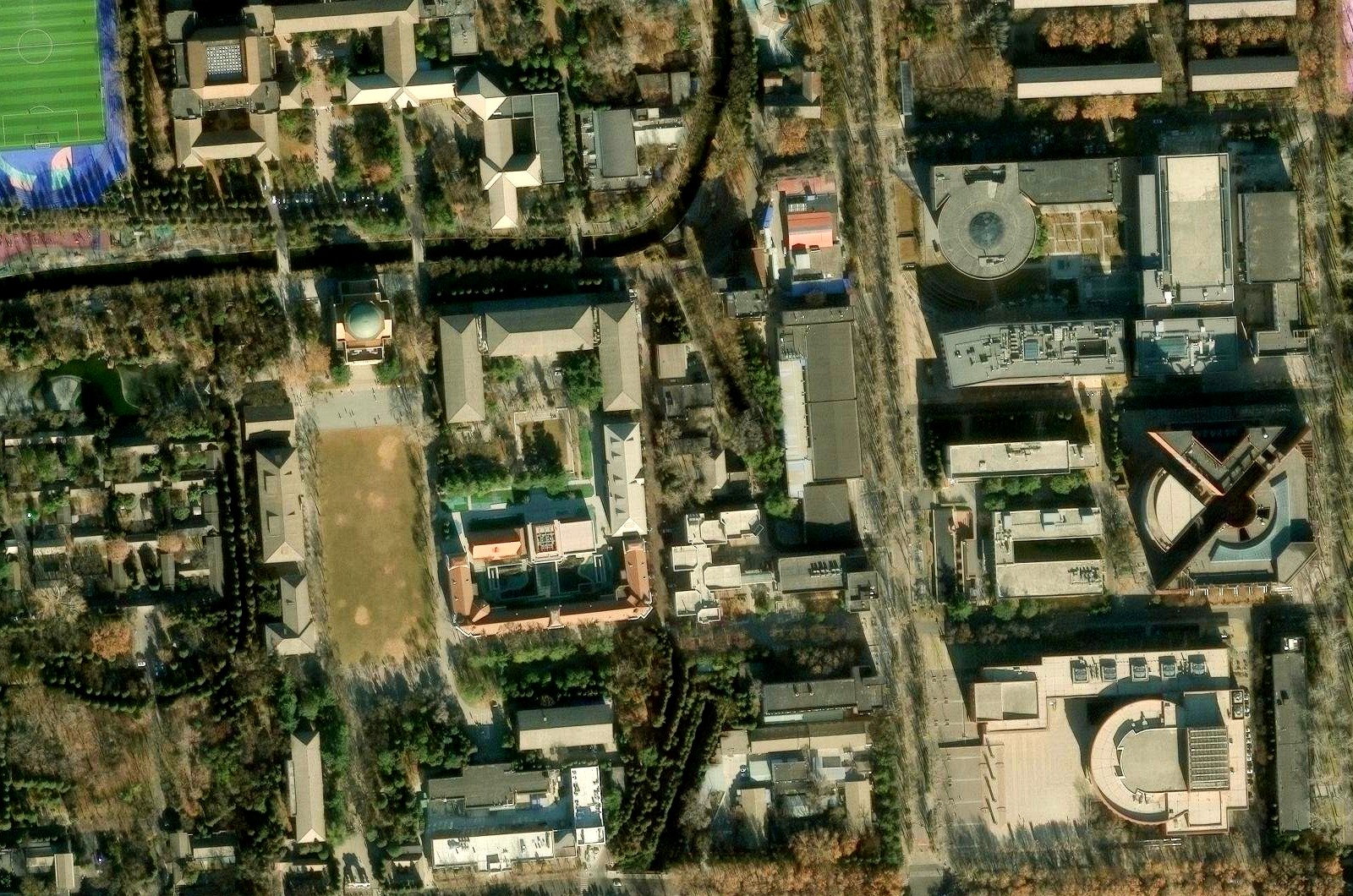
Imagery: Esri World Imagery (Maxar, Earthstar Geographics), shown for demonstration
🎬HD Satellite Video of the Campus
A satellite flyover of the campus · play / pause and fullscreen supported; downloading is disabled.
🎯Satellite Image Target Recognition
Switch tabs to explore AI recognition for farmland, trees, vehicles and boats. Click a cover to open its topic page.
Farmland Recognition
Sub-meter imagery automatically delineates field parcels and crop structure, supporting yield estimation and farmland protection.
Tree Recognition
Single-tree crown extraction and forest classification for precise green-coverage and street-tree statistics.
Vehicle Recognition
Automatic vehicle counting and illegal-parking detection — 0.5m imagery resolves individual car outlines for traffic analysis.
Boat Recognition
Automatic detection, classification and tracking of inland and coastal vessels for water management and emergencies.