How to purchase China high-resolution Satellite images.
China has become one of the world’s most active providers of commercial remote sensing data. For European and North American companies, purchasing Chinese high-resolution satellite imagery can be practical, cost-effective, and technically reliable when handled through an experienced service partner that understands both international business workflows and China’s satellite data ecosystem.
Major Chinese Satellite Resources
Jilin-1 Satellite
Jilin-1 is one of China’s most dynamic commercial satellite constellations. It is widely used for urban monitoring, land management, agriculture, infrastructure, environmental monitoring, and commercial mapping projects.
 ⛶
⛶
 ⛶
⛶
 ⛶
⛶
SuperView-1 Satellite
SuperView-1, also known as Gaojing-1, provides high-resolution commercial imagery suitable for mapping, urban development, engineering planning, natural resource management, and international commercial applications.
 ⛶
⛶
 ⛶
⛶
 ⛶
⛶
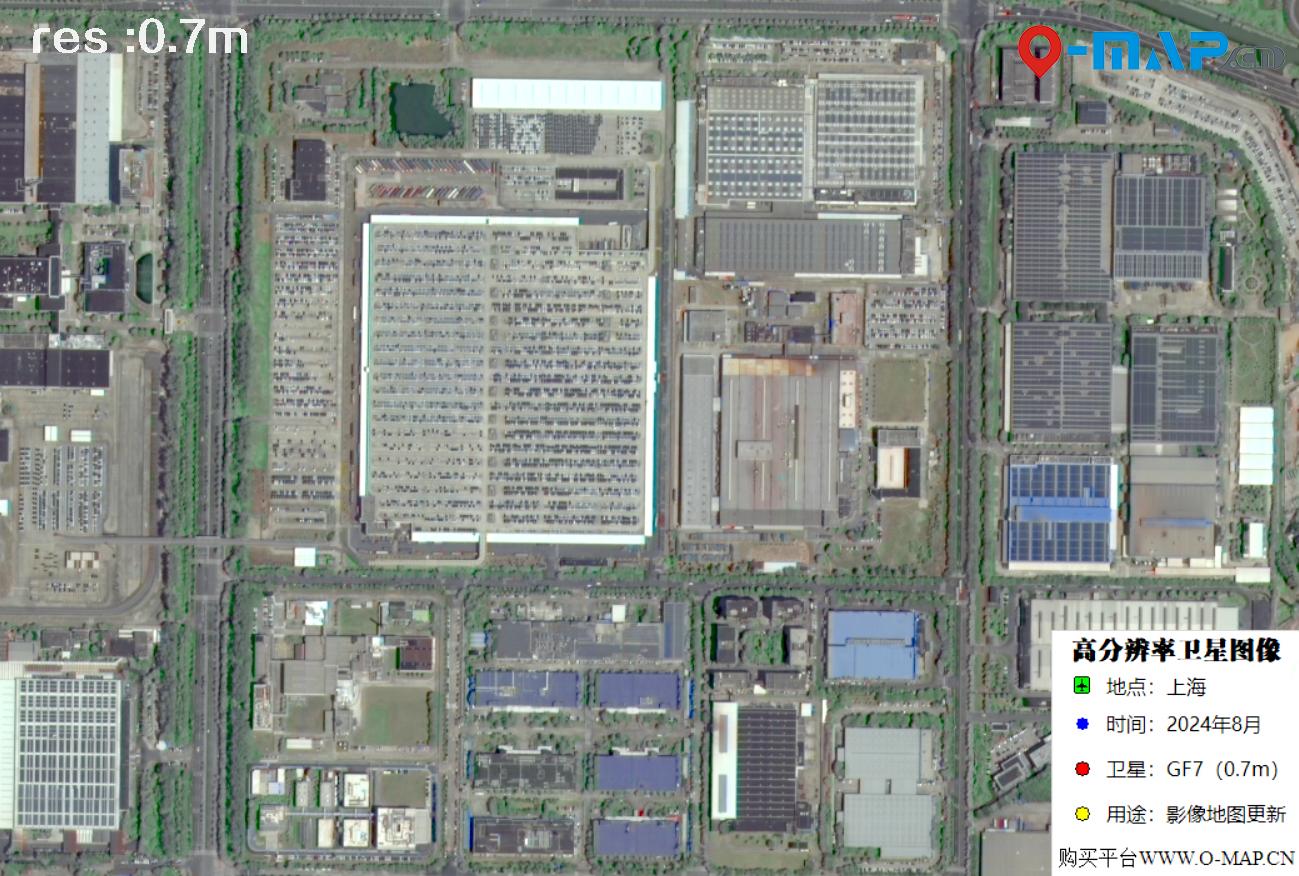
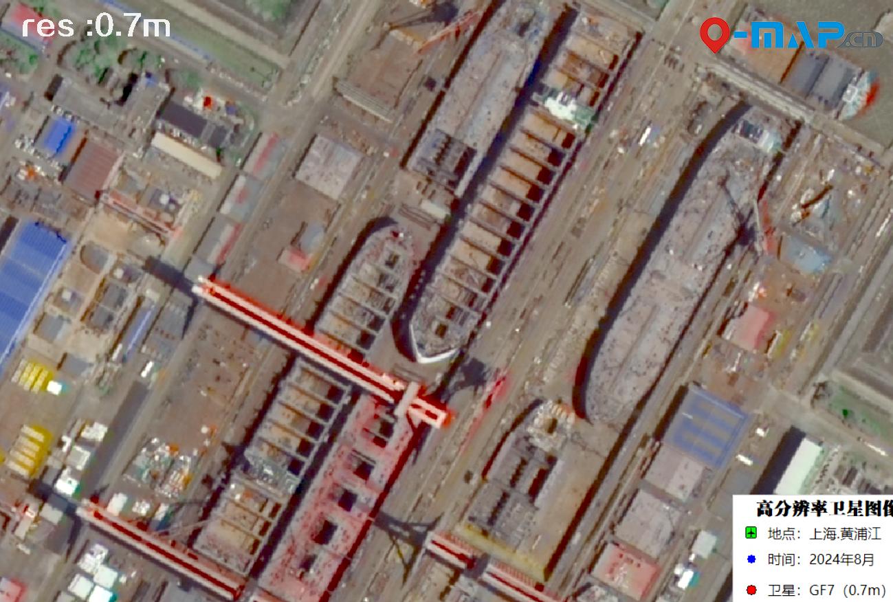
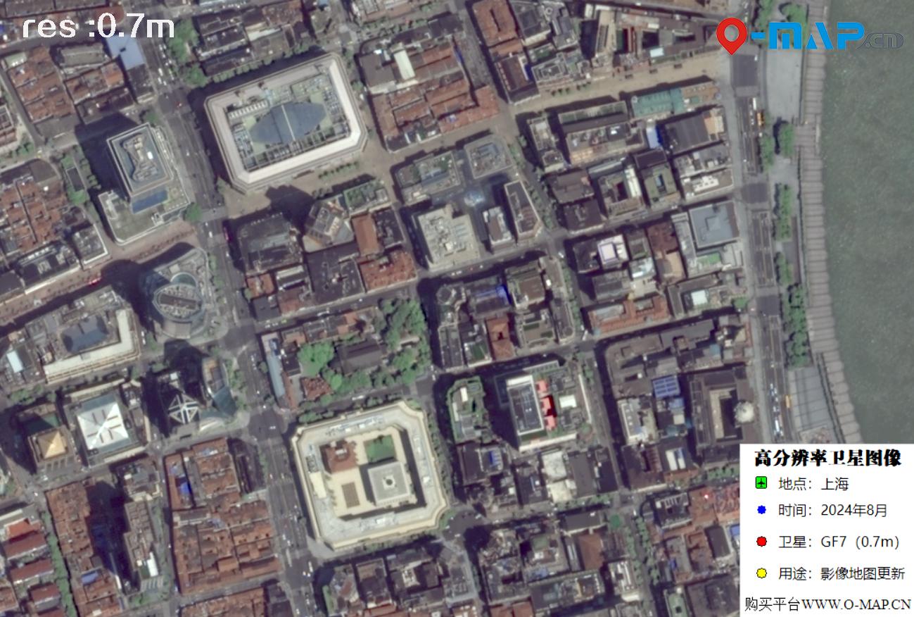
GF-7 Satellite
GF-7 is an advanced Chinese high-resolution mapping satellite designed for stereo imaging and precision surveying applications. It is valuable for 3D mapping, elevation modeling, natural resource monitoring, and engineering analysis.
 ⛶
⛶
 ⛶
⛶
 ⛶
⛶
GF-1 2-meter Series
The GF-1 series provides reliable 2-meter class imagery for broad-area monitoring and practical geospatial projects. It is suitable for agriculture, forestry, environmental assessment, regional mapping, and medium-scale commercial analysis.
 ⛶
⛶
 ⛶
⛶
 ⛶
⛶
Who Should You Buy From?
Most Chinese satellite operators are large state-owned or institution-backed organizations. They usually have strict procedures, complex internal approval processes, and limited flexibility when communicating with overseas commercial customers, especially during quotation, contract, payment, invoicing, and delivery stages.
For international buyers, it is usually more efficient to work with an experienced service provider such as Beijing Yijingtu Geographic Information Technology Co., Ltd. A professional service partner can provide direct communication, flexible data sourcing, practical technical advice, and one-stop access to multiple Chinese satellite resources without requiring the customer to contact each satellite operator separately.
This approach saves time, reduces communication friction, and helps global companies obtain the most suitable imagery based on area, date range, resolution, processing requirements, and budget.
How to Purchase China Satellite Imagery
Purchasing Chinese satellite imagery is straightforward when the requirements are clearly defined. You can contact us by email or WeChat and provide the basic project information. Our team will then search available archives or evaluate new acquisition options and prepare a professional consultation report for your review.
Email us at accpxdj@gmail.com or contact us on WeChat: xdj_jl.
Send coordinates, a KMZ vector file, a map screenshot, or any clear boundary reference.
Tell us the target acquisition time, resolution from 0.3 m to 10 m, processing purpose, and budget range.
We prepare a report including acquisition date, resolution, satellite name, price, and sample imagery.
We can provide a Chinese contract, a commercial quotation, a Chinese official invoice, or an international invoice.
After payment is received, data processing usually takes 5 to 10 business days. Delivery is made by cloud download link.
The final satellite imagery is normally delivered in GeoTIFF format using the WGS84 geographic coordinate system, which is widely compatible with professional GIS and remote sensing software.